Category:Maps of Wayanad district
Wikimedia category | |||||
| Upload media | |||||
| Instance of | |||||
|---|---|---|---|---|---|
| Category combines topics | |||||
| Wayanad district | |||||
district of Kerala, India  На дороге к Ваянаду  | |||||
| Pronunciation audio | |||||
| Instance of | |||||
| Location | Kerala, India | ||||
| Capital | |||||
| Inception |
| ||||
| Population |
| ||||
| Area |
| ||||
| Elevation above sea level |
| ||||
| Different from | |||||
| official website | |||||
 | |||||
Subcategories
This category has only the following subcategory.
E
Media in category "Maps of Wayanad district"
The following 23 files are in this category, out of 23 total.
-
 03-wayanad.png 746 × 922; 54 KB
-
 03-wayanad.svg 744 × 1,052; 21 KB
-
 BlankMapWayanadSubdistricts.svg 720 × 546; 36 KB
-
 India Kerala Wayanad district.svg 874 × 1,274; 539 KB
-
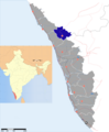
 Location of Wayanad Kerala.png 251 × 420; 9 KB
-
 Malabar District (1951 Census).svg 1,164 × 1,655; 3.24 MB
-
 Nilgiris Biosphere Reserve.jpg 1,120 × 747; 132 KB
-
 Pozhuthana Panchayath Map.jpg 336 × 326; 28 KB
-
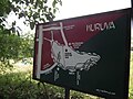 Snap from Kuruvadweep area 9923.JPG 3,648 × 2,736; 3.68 MB
-
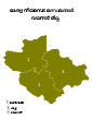
 Subdistricts of Wayanad.png 843 × 637; 80 KB
-
 Wayanad district location map.svg 700 × 766; 1.72 MB
-
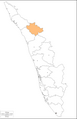 Wayanad district, Kerala.png 914 × 1,415; 73 KB
-
 Wayanad district.png 2,000 × 2,428; 827 KB
-
 Wayanad Kerala location map.svg 1,000 × 1,458; 111 KB
-
 Wayanad Locator map.svg 512 × 343; 2.87 MB
-
 Wayanad-district-map-en by stalin.svg 512 × 343; 59 KB
-
 Wayanad-district-map-en.png 2,658 × 1,780; 366 KB
-
 Wayanad-district-map-en.svg 2,658 × 1,780; 135 KB
-
 Wayanad-district-map-ml.png 2,658 × 1,780; 433 KB
-
 Wayanad-district-map-ml.svg 2,658 × 1,780; 442 KB
-
 Wayanad-meenngadi map-en by stalin.svg 512 × 343; 62 KB
-
 Wayanad.png 800 × 1,166; 184 KB
-
 Waynad map.jpg 2,592 × 1,456; 616 KB


.svg)


