Category:Maps of Werentzhouse
Wikimedia category | |||||
| Upload media | |||||
| Instance of | |||||
|---|---|---|---|---|---|
| Category combines topics | |||||
| Werentzhouse | |||||
commune in Haut-Rhin, France  .svg)  | |||||
| Pronunciation audio | |||||
| Instance of | |||||
| Location |
| ||||
| Located in or next to body of water | |||||
| Population |
| ||||
| Area |
| ||||
| official website | |||||
 | |||||
Media in category "Maps of Werentzhouse"
The following 3 files are in this category, out of 3 total.
-
 68363-Werentzhouse-Hydro.jpeg 5,846 × 4,133; 1.52 MB
-
 68363-Werentzhouse-Sols.png 3,270 × 2,598; 1.37 MB
-
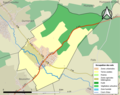
 Map commune FR insee code 68363.png 756 × 605; 26 KB

