Category:Maps of World War II in Greece
Pages in category "Maps of World War II in Greece"
This category contains only the following page.
Media in category "Maps of World War II in Greece"
The following 107 files are in this category, out of 107 total.
-
 1ere Offens Italie Grèce es.svg 427 × 293; 192 KB
-
 1ere Offens Italie Grèce.svg 427 × 293; 192 KB
-
 2eme Offens Italie Grèce es.svg 483 × 332; 256 KB
-
 2eme Offens Italie Grèce.svg 483 × 332; 256 KB
-
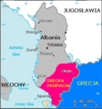 Albania Greek occupation - 2.png 330 × 355; 46 KB
-
 Albania Greek occupation.png 330 × 355; 17 KB
-
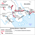
 Bataille de Grèce09041941.PNG 1,257 × 950; 156 KB
-
 Bataille de Grèce09avril1941.PNG 1,258 × 1,242; 166 KB
-
 BatailledeGrèce15041941.JPG 1,052 × 1,116; 161 KB
-
 Battle of Crete, Maleme airfield map.png 752 × 516; 31 KB
-
 Battle of crete-es.svg 1,156 × 880; 752 KB
-
 Battle of crete.svg 1,156 × 880; 1.03 MB
-
 Battle of Greece - 15 April 1941 el.png 565 × 599; 311 KB
-
 Battle of Greece - 15 April 1941.png 565 × 599; 316 KB
-
 Battle of Greece - 1941 el.png 810 × 1,100; 638 KB
-
 Battle of Greece - 1941.png 810 × 1,098; 680 KB
-
 Battle of Greece - 9 April 1941 el.png 601 × 596; 123 KB
-
 Battle of Greece - 9 April 1941.png 601 × 596; 119 KB
-
 Battle of Greece 2.png 609 × 807; 310 KB
-
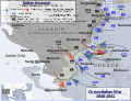
 Battle of Greece WWII 1941 map-en.svg 1,848 × 2,500; 1.6 MB
-
 Battle of Greece WWII 1941 map-es.svg 1,848 × 2,500; 1.6 MB
-
 Battle of Greece WWII 1941 map-fr.svg 1,848 × 2,500; 1.68 MB
-
 Battle of Greece WWII 1941 map-mk.svg 1,848 × 2,500; 2 MB
-
 Battle of Greece WWII map-HE.png 810 × 1,100; 223 KB
-
 Battle of Greece.jpg 1,139 × 1,437; 307 KB
-
 Battle of Heraklion - Allied positions and German drop zones.svg 825 × 559; 1.71 MB
-
 Bitwa o kretę.svg 1,156 × 880; 1.07 MB
-
 Bulgaria during WWII - map explanation.png 1,356 × 196; 90 KB
-
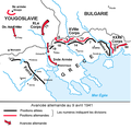
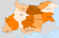
 Map of Bulgaria during WWII-BG.png 1,298 × 862; 255 KB
-
 Map of Bulgaria during WWII-es.svg 1,222 × 810; 813 KB
-
 Map of Bulgaria during WWII-IT.png 4,072 × 2,701; 1.21 MB
-
 Map of Bulgaria during WWII-j.png 800 × 479; 27 KB
-
 Map of Bulgaria during WWII-RU.png 1,305 × 860; 258 KB
-
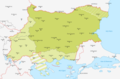
 Map of Bulgaria during WWII.png 1,301 × 855; 253 KB
-
 제2차 세계 대전 기간의 불가리아 지도 설명.png 1,356 × 196; 30 KB
-
 제2차 세계 대전 기간의 불가리아.png 1,301 × 855; 192 KB
-
 Administrative map of Bulgaria during WWII de.svg 715 × 461; 165 KB
-
 Administrative map of Bulgaria during WWII sr.svg 715 × 461; 165 KB
-
 Administrative map of Bulgaria during WWII-mk.svg 715 × 461; 213 KB
-
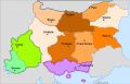
 Administrative map of Bulgaria during WWII.svg 715 × 461; 165 KB
-
 Map of Bulgaria WWII.gif 715 × 461; 20 KB
-
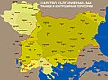
 KingdomOfBulgaria1941-1944.png 2,500 × 1,770; 1,003 KB
-
 Bg IIWW MAP.jpg 800 × 538; 189 KB
-
 Bulgarian lends in WWII.jpg 3,021 × 2,232; 2.23 MB
-
 Campagna italiana di Grecia - Invasione italiana.svg 1,097 × 844; 975 KB
-
 Campagna italiana di Grecia - Offensiva greca.svg 1,097 × 844; 1.11 MB
-
 CampañaDeGrecia15041941.svg 1,262 × 981; 485 KB
-
 Contre-Offens Grèce Italie es.svg 427 × 293; 256 KB
-
 Contre-Offens Grèce Italie.svg 427 × 293; 256 KB
-
 German assault on Crete.jpg 1,256 × 956; 396 KB
-
 Gr-triple-occupation-ES.png 899 × 917; 81 KB
-
 Gr-triple-occupation-gr.png 899 × 917; 72 KB
-
 Gr-triple-occupation-Česky.JPG 884 × 876; 83 KB
-
 Gr-triple-occupation.png 899 × 917; 82 KB
-
 Greece occupation1.png 811 × 847; 68 KB
-
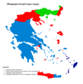
 Greece-1941-1944.png 899 × 917; 90 KB
-
 Greek Offensive 1940 41 in Northern Epirus el.svg 1,097 × 844; 766 KB
-
 Greek Offensive 1940 41 in Northern Epirus-2-es.svg 1,097 × 844; 1.06 MB
-
 Greek Offensive 1940 41 in Northern Epirus-2.svg 1,097 × 844; 1.06 MB
-
 Greek Offensive 1940 41 in Northern Epirus.svg 1,097 × 844; 769 KB
-
 Greek Offensive Epirus-2-hu.svg 1,097 × 844; 1.06 MB
-
 GreekItalian2ndItal-gr.jpg 486 × 335; 39 KB
-
 GreekItalian2ndItal.JPG 486 × 335; 48 KB
-
 GreekItalianGreekCounter-gr.jpg 429 × 295; 35 KB
-
 GreekItalianGreekCounter.JPG 429 × 295; 43 KB
-
 GreekItalianinitialItal-gr.jpg 429 × 295; 35 KB
-
 GreekItalianinitialItal.JPG 429 × 295; 42 KB
-
 Griechische Gegenoffensive.png 300 × 500; 50 KB
-
 Griechische-Offensive-3.png 330 × 355; 19 KB
-
 GuerraItaloGriega28101940.svg 1,052 × 1,116; 178 KB
-
 IItalo-Grecian War 194101 es.svg 451 × 456; 3.13 MB
-
 IItalo-Grecian War 194104 es.svg 451 × 456; 3.44 MB
-
 Italian Invasion 1940 in Pindus Epirus el.svg 1,097 × 844; 735 KB
-
 Italian Invasion 1940 in Pindus Epirus-es.svg 1,202 × 858; 731 KB
-
 Italian Invasion 1940 in Pindus Epirus.svg 1,097 × 844; 737 KB
-
 Italo-Grecian War 1940 11 es.svg 451 × 456; 3.16 MB
-
 Italo-Grecian War 1940 11.svg 451 × 456; 2.75 MB
-
 Italo-Grecian War 1941 01.svg 451 × 456; 2.75 MB
-
 Italo-Grecian War 1941 04.svg 451 × 456; 2.76 MB
-
 Map of Bulgaria during WWII-mk.svg 1,222 × 810; 720 KB
-
 Map of Greece during WWII-IT.png 2,693 × 2,083; 848 KB
-
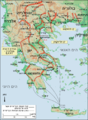
 Map of Greece during WWII.png 1,717 × 1,334; 480 KB
-
 Map, cloth EPH1809.jpg 800 × 659; 141 KB
-
 New Zealand Divisional Cavalry Positions in Crete.png 814 × 544; 299 KB
-
 NZ Division positions Aliakmon.png 492 × 654; 240 KB
-
 Occupation de la grece (1941-1944) -fr.png 851 × 869; 113 KB
-
 Occupation-de-la-grece-he.png 899 × 917; 86 KB
-
 OcupaciónDeGreciaPorElEje.svg 800 × 917; 548 KB
-
 OcupaciónGriegaDeAlbania 1940-1941-hu.svg 1,700 × 1,700; 149 KB
-
 OcupaciónGriegaDeAlbania19401941.svg 1,700 × 1,700; 235 KB
-
 Offensive italienne1.heb.svg 427 × 293; 192 KB
-
 OperaciónMarita15041941.svg 1,055 × 877; 375 KB
-
 Pind-Meglen.png 200 × 204; 23 KB
-
 PL-triple-occupation.png 899 × 917; 100 KB
-
 Responsability zones Mac WW II.jpg 517 × 395; 58 KB
-
 Rethymno positions, 20 May 1941.svg 858 × 510; 1.6 MB
-
 Tripla occupazione greca.gif 899 × 917; 35 KB
-
 Triple occupation of Greece de.svg 812 × 763; 109 KB
-
 Triple occupation of Greece el.svg 1,158 × 1,147; 91 KB
-
 Triple occupation of Greece es.svg 1,158 × 1,147; 78 KB
-
 Triple occupation of Greece mk.svg 812 × 763; 359 KB
-
 Triple occupation of Greece-zh.svg 812 × 763; 113 KB
-
 Triple Occupation of Greece.png 899 × 917; 186 KB
-
 Triple occupation of Greece2 es.svg 1,158 × 1,147; 191 KB
-
 WorldWarIILocationMapGR.png 630 × 766; 23 KB
-
 Ελληνοϊταλικός Πόλεμος 28101940.svg 1,052 × 1,116; 178 KB
-
 Κλειδί 12 Απρ 1630-1800 (100dpi).jpg 4,122 × 3,425; 1.34 MB


_-fr.png)


.jpg)