Category:Maps of Yeniseysk Governorate
Wikimedia category | |||||
| Upload media | |||||
| Instance of | |||||
|---|---|---|---|---|---|
| Category combines topics | |||||
| Yeniseysk Governorate | |||||
Governate of the Russian Empire, Republic, and RSFSR   .svg)  | |||||
| Instance of |
| ||||
| Location | Russian Soviet Federative Socialist Republic | ||||
| Capital | |||||
| Inception |
| ||||
| Dissolved, abolished or demolished date |
| ||||
| Population |
| ||||
| Replaces | |||||
| Replaced by | |||||
 | |||||
Media in category "Maps of Yeniseysk Governorate"
The following 15 files are in this category, out of 15 total.
-
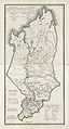
 Eniseisk governorate 1825.jpg 4,893 × 9,133; 9.27 MB
-
 Карта Енисейской Губернии.jpg 4,893 × 9,133; 13.34 MB
-
 Map of Yeniseysk Governorate, 1835.gif 1,423 × 1,930; 1.14 MB
-
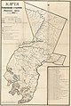 Karta Eniseĭskoĭ gubernīi Achinskago okruga - sostavlena 1859 goda. LOC 2010588567.jpg 7,453 × 11,117; 8.38 MB
-
 Karta Eniseĭskoĭ gubernīi Achinskago okruga - sostavlena 1859 goda. LOC 2010588567.tif 7,453 × 11,117; 237.05 MB
-
 Karta Eniseĭskoĭ gubernīi Achinskago okruga - sostavlena 1859 goda. LOC 2010588568.jpg 7,406 × 11,178; 8.27 MB
-
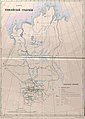 Карта Енисейской губернии 1859 г..jpg 1,425 × 2,000; 1.22 MB
-
 Das Mündungs-Gebiet des Ob und Jenissei - UvA-BC OTM HB-KZL 31 02 37.jpg 3,859 × 3,160; 20.9 MB
-
 NORDENSKIÖLD(1877) p119.jpg 1,807 × 5,698; 1.8 MB
-

-
 Enisey gub.jpg 1,865 × 4,026; 2.89 MB
-
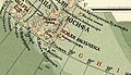 Yenisey gub - section - Franz Josef Land.jpg 759 × 439; 190 KB
-
 Карта Енисейской губернии.jpg 4,283 × 5,651; 7.19 MB
-
 Yeniseisk in Russian Empire (1914).svg 581 × 343; 310 KB
-
 Admiralty Chart No 13 Siberia Dickson Harbour to Taimuir Gulf, Published 1916.jpg 12,574 × 8,510; 11.17 MB


_och_dess_svenska_f%C3%B6reg%C3%A5ngare_j%C3%A4mte_en_kortfattad_framst%C3%A4llning_af_nordostpassagens_historia_och_den_amerikanska_nordpols-expeditionen_under_De_Long,_etc%27_(11204037773).jpg)


_p119.jpg)