Category:Maps of Yugoslavia during World War II
Subcategories
This category has the following 6 subcategories, out of 6 total.
Media in category "Maps of Yugoslavia during World War II"
The following 200 files are in this category, out of 260 total.
(previous page) (next page)-
 "Vlaška Mala" from 22nd to 25th of May 1945.jpg 1,083 × 736; 214 KB
-
 "Vlaška Mala" from 23rd to 28th of April 1945.jpg 740 × 732; 148 KB
-
 "Vlaška Mala" on the 22nd of May 1945.jpg 708 × 773; 162 KB
-
 1941governatoratodalmazia.png 361 × 339; 78 KB
-
 1944 Yugoslavia liberated territories.jpg 1,165 × 973; 1.29 MB
-
 1944 Yugoslavia liberated territories.svg 1,553 × 1,297; 2.28 MB
-
 2차 대전 기간 알바니아의 지도.png 647 × 839; 115 KB
-
 Map of Albania during Worl War 2.png 647 × 839; 156 KB
-
 Map of Albania during WWII-CS.png 1,005 × 1,305; 281 KB
-
 Map of Albania during WWII-IT.png 1,030 × 1,306; 292 KB
-
 Map of Albania during WWII-SQ.png 643 × 839; 158 KB
-
 Map of Albania during WWII.png 647 × 839; 187 KB
-
 GranAlbania 1941-hu.svg 1,725 × 2,115; 243 KB
-
 GranAlbania1941 sr.svg 1,725 × 2,115; 185 KB
-
 GranAlbania1941.svg 1,725 × 2,115; 466 KB
-
 KingdomOfAlbania1941.png 1,698 × 3,000; 870 KB
-
 KingdomOfAlbania1943.png 2,300 × 3,700; 948 KB
-
 Albia.png 1,918 × 1,699; 813 KB
-
 AtlBalk1942.jpg 318 × 327; 141 KB
-
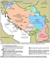
 Fascist occupation of yugoslavia-sr.png 1,076 × 1,188; 164 KB
-
 Fascist occupation of yugoslavia.png 1,076 × 1,239; 172 KB
-
 Occupation de la Yougoslavie par l'Axe, 1941-43-es.svg 1,504 × 1,509; 681 KB
-
 Occupation de la Yougoslavie par l'Axe, 1941-43.svg 1,494 × 2,051; 193 KB
-
 Axis occupation of Yugoslavia, 1941-43.png 1,076 × 1,190; 170 KB
-
 Axis occupation of Yugoslavia 1941-43 Hebrew.png 542 × 599; 136 KB
-
 Axis occupation of Yugoslavia, 1943-44-es.svg 1,504 × 1,509; 699 KB
-
 Axis occupation of Yugoslavia, 1943-44.png 1,076 × 1,190; 172 KB
-
 Occupation de la Yougoslavie par l'Axe, 1943-44.png 1,076 × 1,190; 167 KB
-
 Axis occupation of Yugoslavia 1941-43 hu.svg 1,047 × 894; 87 KB
-
 Axis occupation of Yugoslavia 1941-43 legend.png 1,047 × 1,152; 179 KB
-
 Axis occupation of Yugoslavia 1941-43.png 1,047 × 894; 50 KB
-
 Axis occupation of Yugoslavia 1943-44.png 1,047 × 894; 90 KB
-
 Fascist concentration camps in yugoslavia.png 1,076 × 1,326; 197 KB
-
 Fascist concentration camps in yugoslavia-sr.png 1,076 × 1,275; 190 KB
-
 Fascist genocide in yugoslavia.png 1,076 × 1,260; 183 KB
-
 Fascist genocide in yugoslavia-sr.png 1,076 × 1,209; 176 KB
-
 Užice and Bihać Republics.png 1,076 × 1,007; 135 KB
-
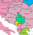
 Bihać Republic.png 1,076 × 1,007; 131 KB
-
 Jvuo1942 en.png 1,076 × 1,007; 132 KB
-
 Jvuo1942 sr.png 1,076 × 1,007; 126 KB
-
 Jvuo commanders 1943 en.png 1,076 × 1,007; 132 KB
-
 Jvuo commanders 1943 sr.png 1,076 × 1,007; 126 KB
-
 Zone odgovornosti četnika, prema sporazumu sa Nemcima.png 800 × 652; 196 KB
-
 Yugoslavia moljevic1941 en.png 1,076 × 1,000; 115 KB
-
 Yugoslavia moljevic1941 sr.png 1,076 × 1,007; 131 KB
-
 Serbia moljevic1941 en.png 1,076 × 1,007; 130 KB
-
 Serbia moljevic1941 sr.png 1,076 × 1,007; 124 KB
-
 Svesrbija en.png 1,076 × 1,007; 131 KB
-
 Svesrbija sr.png 1,076 × 1,007; 125 KB
-
 1941-1943 Axis occupation of Yugoslavia map - en.svg 1,613 × 1,471; 2.89 MB
-
 1941-1943 Axis occupation of Yugoslavia map - es.svg 1,613 × 1,471; 690 KB
-
 1941-1943 Axis occupation of Yugoslavia map - hr.svg 1,613 × 1,471; 2.89 MB
-
 1941-1943 Axis occupation of Yugoslavia map - ru.svg 1,613 × 1,471; 2.89 MB
-
 1941-1943 Axis occupation of Yugoslavia map - sr.svg 1,613 × 1,471; 2.89 MB
-
 1941-1943 Axis occupation of Yugoslavia map-hu.svg 1,613 × 1,471; 415 KB
-
 1941-1943 Axis occupation of Yugoslavia map.svg 1,613 × 1,471; 2.42 MB
-
 1942 JVuO control map - en.svg 1,613 × 1,471; 984 KB
-
 1942 JVuO control map - es.svg 1,613 × 1,471; 482 KB
-
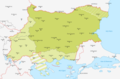
 Balcans 1942.png 651 × 698; 86 KB
-
 Balkans Animation 1800-2008.gif 744 × 618; 542 KB
-
 Bitka na Neretvi.jpg 2,000 × 2,107; 1.23 MB
-
 Bitka za Kozaru.jpg 2,000 × 1,416; 1.03 MB
-
 Borbe oko Beograda 1944.jpg 2,000 × 2,344; 1.38 MB
-
 Borbe tokom desanta na Drvar.jpg 3,000 × 2,487; 2.06 MB
-
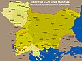
 Bulgaria 1944 WWII svg.png 266 × 329; 49 KB
-
 Bulgaria during WWII - map explanation.png 1,356 × 196; 90 KB
-
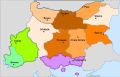
 Map of Bulgaria during WWII-BG.png 1,298 × 862; 255 KB
-
 Map of Bulgaria during WWII-es.svg 1,222 × 810; 813 KB
-
 Map of Bulgaria during WWII-IT.png 4,072 × 2,701; 1.21 MB
-
 Map of Bulgaria during WWII-j.png 800 × 479; 27 KB
-
 Map of Bulgaria during WWII-RU.png 1,305 × 860; 258 KB
-
 Map of Bulgaria during WWII.png 1,301 × 855; 253 KB
-
 제2차 세계 대전 기간의 불가리아 지도 설명.png 1,356 × 196; 30 KB
-
 제2차 세계 대전 기간의 불가리아.png 1,301 × 855; 192 KB
-
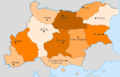
 Administrative map of Bulgaria during WWII de.svg 715 × 461; 165 KB
-
 Administrative map of Bulgaria during WWII sr.svg 715 × 461; 165 KB
-
 Administrative map of Bulgaria during WWII-mk.svg 715 × 461; 213 KB
-
 Administrative map of Bulgaria during WWII.svg 715 × 461; 165 KB
-
 Map of Bulgaria WWII.gif 715 × 461; 20 KB
-
 KingdomOfBulgaria1941-1944.png 2,500 × 1,770; 1,003 KB
-
 Bg IIWW MAP.jpg 800 × 538; 189 KB
-
 Bulgarian lends in WWII.jpg 3,021 × 2,232; 2.23 MB
-
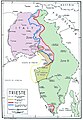 Confini Trieste-Istria2.jpg 1,471 × 2,130; 371 KB
-
 Croatia march-may 1945 battlefronts.gif 562 × 324; 338 KB
-
 Croatia-41-45 hu.png 1,200 × 912; 327 KB
-
 DefensaYugoslavaAbril1941.svg 1,882 × 1,553; 394 KB
-
 Desant na Drvar.jpg 2,000 × 1,755; 1.19 MB
-
 Druga neprijateljska ofanzi.jpg 2,838 × 3,052; 2.46 MB
-
 EstadoIndependienteDeCroaciaEn1941.svg 748 × 736; 1.54 MB
-
 Fascist occupation of yugoslavia hu.png 1,255 × 1,446; 604 KB
-
 Hungarian Occupied Yugoslavia 1941 44.png 1,032 × 659; 249 KB
-
 Ndh 1941-hr.png 722 × 669; 62 KB
-
 Ndh 1941-sr.png 722 × 669; 63 KB
-
 Ndh 1941.png 722 × 669; 63 KB
-
 Independent State of Croatia 1941-43.png 702 × 638; 62 KB
-
 Ndh 1941-fr.svg 722 × 669; 49 KB
-
 NezavisnaDrzavaHrvatska - infobox version.png 1,780 × 1,580; 216 KB
-
 NezavisnaDrzavaHrvatska.png 2,000 × 1,576; 643 KB
-
 NezavisnaDrzavaHrvatskaDistricts.png 2,000 × 1,576; 1.05 MB
-
 NezavisnaDrzavaHrvatska - infobox collage.png 1,780 × 3,160; 464 KB
-
 NezavisnaDrzavaHrvatska1943 - infobox version.png 1,780 × 1,580; 248 KB
-
 NezavisnaDrzavaHrvatska1943.png 2,000 × 1,576; 664 KB
-
 NezavisnaDrzavaHrvatskaDistricts1943.png 2,000 × 1,575; 1.02 MB
-
 Independent State Of Croatia 1941 Locator Map.png 1,220 × 1,200; 299 KB
-
 Independent State Of Croatia 1943 Locator Map.png 1,220 × 1,200; 257 KB
-
 Great Parishes of NDH after September 1943.png 555 × 529; 240 KB
-
 Croatia 41 45 en.gif 600 × 500; 19 KB
-
 Croatia 41 45.gif 588 × 447; 23 KB
-
 Croatia-41-45.gif 588 × 447; 21 KB
-
 NDH-Croacia1941-1945.svg 2,647 × 1,995; 217 KB
-
 Independent State Of Croatia 1941 Locator Map.svg 748 × 736; 1,014 KB
-
 Independent State of Croatia.png 1,827 × 1,645; 126 KB
-
 Invasion of Yugoslavia lines of attack Why We Fight no. 5-es.svg 445 × 321; 349 KB
-
 InvasiónDeYugoslaviaAbrilDe1941.svg 1,776 × 1,471; 960 KB
-
 Jugoslavija i Evropa maj 1943.jpg 1,209 × 983; 1.07 MB
-
 Jugoslavija u drugom svetskom ratu.png 5,000 × 4,267; 1.03 MB
-
 Kapitulacija Italije i ustanak u okupiranoj Jugoslaviji 1943.png 1,984 × 1,455; 1.78 MB
-
 Kosovo 1941-sr.png 663 × 772; 48 KB
-
 Kosovo 1941.png 663 × 772; 54 KB
-
 Kretanje snaga jvuo 1945 (en).png 984 × 1,010; 91 KB
-
 Kretanje snaga jvuo 1945.png 984 × 1,010; 92 KB
-
 Macedonia 1944 en.png 556 × 780; 39 KB
-
 Macedonia 1944 mk.png 556 × 780; 40 KB
-
 Macedonia 1944 sr.png 556 × 780; 40 KB
-
 Madjarska okupacija Backe i Baranje, 1941-1944.png 886 × 864; 67 KB
-
 Ethnographic map of Backa and Baranja 1931.png 795 × 583; 30 KB
-
 Map of Bulgaria during WWII-mk.svg 1,222 × 810; 720 KB
-
 Map of invasion of Yugoslavia - Northeastern section map.svg 1,420 × 900; 4.57 MB
-
 Map of invasion of Yugoslavia - Northwestern section map.svg 1,421 × 900; 5.4 MB
-
 Map of invasion of Yugoslavia - Situation map.svg 1,300 × 1,136; 4.52 MB
-
 Map of invasion of Yugoslavia - Southeastern section map.svg 1,421 × 1,141; 5.11 MB
-
 Map of invasion of Yugoslavia - Southwestern section map.svg 1,420 × 1,141; 2.7 MB
-
 Map of Kosovo during WW II.png 783 × 524; 97 KB
-
 Map of the Axis occupation of Yugoslavia-es.svg 1,672 × 1,509; 559 KB
-
 Map of the Axis occupation of Yugoslavia.svg 1,672 × 1,509; 853 KB
-
 Map of Vardar Macedonia during WW II.png 814 × 666; 135 KB
-
 Map of Yugoslavia during the 1941 German invasion.png 890 × 689; 193 KB
-
 Montenegro during ww2.png 670 × 918; 49 KB
-
 ЦГ током другог св рата.png 670 × 918; 50 KB
-
 Montenegro1941 1944 map.png 724 × 891; 52 KB
-
 Montenegro1941 1944 map sr.png 724 × 891; 53 KB
-
 GovernateOfMontenegro.png 2,000 × 2,189; 577 KB
-
 КраљевинаЦрнаГора1941-44.png 2,000 × 2,189; 561 KB
-
 Map of Montenegro World War Two-fr.svg 1,791 × 1,657; 70 KB
-
 MontenegroDuranteLaSegundaGuerraMundial.svg 1,919 × 1,771; 347 KB
-
 Kingdom of Montenegro (1941-1944).png 1,796 × 1,653; 76 KB
-
 Montenegro venezia.PNG 537 × 613; 56 KB
-
 Venezia Montenegro.svg 479 × 583; 3.38 MB
-
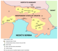
 Nedićeva Srbija.jpg 1,024 × 898; 442 KB
-
 Neprijateljska ofanziva u Sloveniji 1942.jpg 2,000 × 1,834; 1.24 MB
-
 Neprijateljska ofanziva u Sloveniji aprila 1944.jpg 2,456 × 1,710; 1.28 MB
-
 Occupation of vojvodina-sr.png 1,548 × 1,596; 92 KB
-
 Occupation of vojvodina.png 1,548 × 1,653; 129 KB
-
 RepartoDeVoivodinaEnLaSegundaGuerraMundial.svg 1,548 × 1,653; 470 KB
-
 Ocupação da Iugoslávia pelas forças do eixo 1941-1943.svg 1,505 × 2,054; 176 KB
-
 Okupirana Jugoslavija.jpg 2,999 × 2,498; 2.3 MB
-
 Operacija Schwarz.jpg 3,000 × 2,544; 2.17 MB
-
 Operacija Užice.jpg 3,000 × 2,658; 2.57 MB
-
 Operacija Weiss I.jpg 1,644 × 1,286; 864 KB
-
 Operacija Weiss II.jpg 3,000 × 2,562; 1.94 MB
-
 Operacija Weiss.jpg 3,000 × 2,528; 2.23 MB
-
 Operation Frühlingssturm.png 1,594 × 875; 845 KB
-
 Operation25yu.jpg 1,775 × 1,544; 1.03 MB
-
 Oslobođena teritorija maja 1943.jpg 3,000 × 2,554; 2.32 MB
-
 Oslobođena teritorija septembra 1943.jpg 3,000 × 2,555; 2.54 MB
-
 Oslobođena teritorija septembra 1944.jpg 3,000 × 2,509; 2.19 MB
-
 Oslobođena teritorija u vreme napada na Drvar maja 1944.jpg 3,000 × 2,522; 2.36 MB
-
 Oslobođena teritorija u vreme prvog zasedanja AVNOJ-a.jpg 3,000 × 2,513; 2.02 MB
-
 Oslobođena teritorija za vreme drugog zasedanja AVNOJ-a.jpg 3,000 × 2,546; 2.04 MB
-
 Oslobođenje Krupnja 1941.jpg 1,800 × 1,506; 862 KB
-
 Partizanski odredi Jugoslavije.jpg 3,000 × 2,524; 2 MB
-
 Partizanski srem01.png 1,420 × 1,245; 110 KB
-
 Partizanski srem02.png 1,420 × 1,200; 106 KB
-
 PlandeAtaqueAlemánContraYugoslaviaAbrilDe1941.svg 1,882 × 1,553; 370 KB
-
 Proboj na Sutjesci.jpg 2,066 × 2,538; 1.79 MB
-
 Prodor proleterskih brigada u Zapadnu Bosnu.jpg 3,000 × 2,563; 1.97 MB
-
 Provincia di Lubiana1941-1943.jpg 976 × 672; 204 KB
-
 Provincia Fiume1941-1943.jpg 796 × 643; 70 KB
-
 Racija1942 01.png 942 × 1,302; 99 KB
-
 Racija1942 02.png 942 × 1,263; 84 KB
-
 Republic of Uzice.png 529 × 359; 13 KB
-
 Rosselsprung 7th SS 25 May 1944.jpg 1,750 × 1,871; 2.94 MB
-
 Rosselsprung 92 PZG 25 May 1944.jpg 1,240 × 1,049; 1.32 MB
-
 Rosselsprung KG Willam 25 May 1944.jpg 857 × 861; 793 KB
-
 Rosselsprung Recce Regts 25 May 1944.jpg 1,504 × 1,574; 1.97 MB
-
 Sandzak 1943 1945 en.png 980 × 666; 63 KB
-
 Sandzak 1943 1945 sr.png 980 × 666; 61 KB
-
 Serbia1941 01.png 503 × 690; 32 KB
-
 Serbia1941 02.png 503 × 690; 31 KB
-
 Serbia1941 1944 01.png 503 × 690; 32 KB
-
 Serbia1941 1944 02.png 503 × 690; 31 KB
-
 Serbia1941 1944 sr.png 503 × 772; 38 KB
-
 Serbia1941 1944.png 503 × 772; 39 KB
-
 Сербия 1941-1944.jpg 503 × 724; 149 KB
-
 Serbia1941 banovine en.png 503 × 690; 47 KB
-
 Serbia1941 banovine sr.png 503 × 690; 44 KB
-
 Military Administration in Serbia.png 485 × 650; 49 KB
-
 Uzicka republika.png 503 × 690; 34 KB
-
 Uzicka republika-sr.png 503 × 690; 33 KB
-
 Uzicka republika2.png 503 × 690; 34 KB


.png)


.png)


