Category:Maps of Zululand
Media in category "Maps of Zululand"
The following 40 files are in this category, out of 40 total.
-

-
 115 of 'Campaigning in South Africa and Egypt' (11236739385).jpg 2,592 × 3,286; 1.47 MB
-
 (1850) Scetch Map of the Natal Colony (compiled from scetches by Dr. Stranger).jpg 2,386 × 1,743; 2.78 MB
-
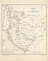
 Map of Zululand, Natal, Transvaal (1879), crop.jpg 2,026 × 1,990; 1.04 MB
-
 Map of Zululand, Natal, Transvaal (1879).jpg 2,026 × 2,830; 2.65 MB
-
 MAP OF SOUTH AFRICA BY R.W. LEYLAND.jpg 3,172 × 2,465; 1.79 MB
-
 189 of 'In Zululand with the British throughout the War of 1879' (11137449926).jpg 2,440 × 1,237; 487 KB
-
 1895 political map of South Africa, from the Castle Line Atlas 90.jpg 3,084 × 1,992; 784 KB
-
 1896 original carte ancienne de Republique Sud-Africaine Transvaal.jpg 2,338 × 1,700; 713 KB
-
 22 of 'The Kafirs of Natal and the Zulu Country' (11051283136).jpg 1,391 × 2,163; 454 KB
-
-
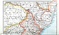
 Africa (1878) (14589740028).jpg 1,488 × 2,932; 1.27 MB
-
 Cape Colony and neighbouring states 1870-1890 b.jpg 1,368 × 992; 159 KB
-
 Cape Colony map 1876 - Eve of Confederation Wars.jpg 1,034 × 793; 687 KB
-

-

-
 Great Trek map full EU.png 4,636 × 3,973; 2.47 MB
-
 Great Trek map full.png 4,636 × 3,973; 2.53 MB
-
 Karte der Neuen Republik.jpg 2,526 × 2,242; 2.24 MB
-
 Map of KwaZulu-Natal with Zululand highlighted (2016).svg 712 × 805; 722 KB
-
 Map of seat of war in South Africa second Boer War.jpg 2,500 × 1,488; 373 KB
-
 Map of the Seat of War in Africa, upper part.tif 4,163 × 2,951; 35.17 MB
-

-

-

-
 Shaka's Empire map.svg 2,031 × 1,741; 5.79 MB
-
 South Africa and the Transvaal war (1900) (14778292761).jpg 3,222 × 1,842; 471 KB
-
 South Africa and the Transvaal War (1900) (14786183493).jpg 2,318 × 2,948; 1.11 MB
-
 SouthAfrica1885.svg 1,713 × 1,435; 79 KB
-
 Southern Africa Comprising Cape Colony, Natal, & c. by Keith Johnston, F.R.S.E.jpg 6,261 × 3,966; 21.25 MB
-

-

-
 Sud d'Africa vèrs 1820-1840.png 702 × 525; 96 KB
-
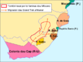
 The Cape Colony - 1878.jpg 1,987 × 1,606; 1.02 MB
-
-

-
 The Groot Trek map He.png 1,420 × 1,748; 349 KB
-

-
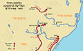 Zulu-map-Hebrew.jpg 763 × 474; 198 KB
-
 Zululand 1878.png 427 × 830; 759 KB
.jpg)
.jpg)
_Scetch_Map_of_the_Natal_Colony_(compiled_from_scetches_by_Dr._Stranger).jpg)

.jpg)

.jpg)
.jpg)
_(14589740028).jpg)


_-_btv1b84595800.jpg)


.svg)


_(14562999860).jpg)


.jpg)


_(page_6_crop).jpg)


,_crop.jpg)
.jpg)
_(14778292761).jpg)
_(14786183493).jpg)