Category:Maps of cantons of Yvelines
Departments of Metropolitan France: Ain [01] · Aisne [02] · Allier [03] · Alpes-de-Haute-Provence [04] · Hautes-Alpes [05] · Alpes-Maritimes [06] · Ardèche [07] · Ardennes [08] · Ariège [09] · Aube [10] · Aude [11] · Aveyron [12] · Bouches-du-Rhône [13] · Calvados [14] · Cantal [15] · Charente [16] · Charente-Maritime [17] · Cher [18] · Corrèze [19] · Corse-du-Sud [2A]† · Haute-Corse [2B]† · Côte-d’Or [21] · Côtes-d'Armor [22] · Creuse [23] · Dordogne [24] · Doubs [25] · Drôme [26] · Eure [27] · Eure-et-Loir [28] · Finistère [29] · Gard [30] · Haute-Garonne [31] · Gers [32] · Gironde [33] · Hérault [34] · Ille-et-Vilaine [35] · Indre [36] · Indre-et-Loire [37] · Isère [38] · Jura [39] · Landes [40] · Loir-et-Cher [41] · Loire [42] · Haute-Loire [43] · Loire-Atlantique [44] · Loiret [45] · Lot [46] · Lot-et-Garonne [47] · Lozère [48] · Maine-et-Loire [49] · Manche [50] · Marne [51] · Haute-Marne [52] · Mayenne [53] · Meurthe-et-Moselle [54] · Meuse [55] · Morbihan [56] · Moselle [57] · Nièvre [58] · Nord [59] · Oise [60] · Orne [61] · Pas-de-Calais [62] · Puy-de-Dôme [63] · Pyrénées-Atlantiques [64] · Hautes-Pyrénées [65] · Pyrénées-Orientales [66] · Bas-Rhin [67] · Haut-Rhin [68] · departmental district of the Rhône [69] · Haute-Saône [70] · Saône-et-Loire [71] · Sarthe [72] · Savoie [73] · Haute-Savoie [74] · Seine-Maritime [76] · Seine-et-Marne [77] · Yvelines [78] · Deux-Sèvres [79] · Somme [80] · Tarn [81] · Tarn-et-Garonne [82] · Var [83] · Vaucluse [84] · Vendée [85] · Vienne [86] · Haute-Vienne [87] · Vosges [88] · Yonne [89] · Territoire de Belfort [90] · Essonne [91] · Hauts-de-Seine [92] · Seine-Saint-Denis [93] · Val-de-Marne [94] · Val-d'Oise [95]
Overseas departments and regions: Guadeloupe [971] · Martinique [972] · French Guiana [973] · Mayotte [976]
Overseas departments and regions: Guadeloupe [971] · Martinique [972] · French Guiana [973] · Mayotte [976]
Subcategories
This category has the following 3 subcategories, out of 3 total.
*
Media in category "Maps of cantons of Yvelines"
The following 52 files are in this category, out of 52 total.
-
 Canton Plaisir.svg 371 × 369; 15 KB
-
 Cantons des Yvelines 2015.svg 1,000 × 1,253; 20 KB
-
 Cantons des Yvelines 2021.svg 478 × 599; 85 KB
-
 Cantons Poissy Nord Sud.svg 734 × 721; 30 KB
-
 Carte des cantons des Yvelines en 1967.png 1,044 × 1,273; 157 KB
-
 Carte des Cantons des Yvelines en 1969.png 1,044 × 1,273; 158 KB
-
 Carte des Cantons des Yvelines en 1976.png 1,044 × 1,273; 158 KB
-
 Carte des Cantons des Yvelines en 1982.png 1,044 × 1,273; 158 KB
-
 Carte des Cantons des Yvelines en 1985.png 1,044 × 1,273; 158 KB
-
 Carte Yvelines cantons w.svg 735 × 909; 190 KB
-
 Département Yvelines Arrondissement Kantone 2019.png 2,500 × 3,049; 1.19 MB
-
 Département Yvelines Kantone 2019.png 2,500 × 3,049; 1.16 MB
-
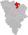
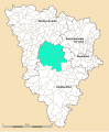
 Yvelines - Canton Aubergenville 2015.svg 1,000 × 1,253; 20 KB
-
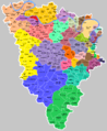
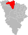
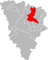
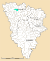
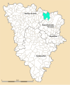
 Yvelines - Canton Bonnières-sur-Seine 2015.svg 1,000 × 1,253; 20 KB
-
 Yvelines - Canton Chatou 2015.svg 1,000 × 1,253; 20 KB
-
 Yvelines - Canton Conflans-Sainte-Honorine 2015.svg 1,000 × 1,253; 20 KB
-
 Yvelines - Canton Houilles 2015.svg 1,000 × 1,253; 20 KB
-
 Yvelines - Canton Le Chesnay 2015.svg 1,000 × 1,253; 20 KB
-
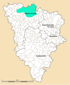
 Yvelines - Canton Les Mureaux 2015.svg 1,000 × 1,253; 21 KB
-
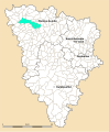
 Yvelines - Canton Limay 2015.svg 1,000 × 1,253; 20 KB
-
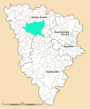
 Yvelines - Canton Mantes-la-Jolie 2015.svg 1,000 × 1,253; 20 KB
-
 Yvelines - Canton Maurepas 2015.svg 1,000 × 1,253; 20 KB
-
 Yvelines - Canton Montigny-le-Bretonneux 2015.svg 1,000 × 1,253; 20 KB
-
 Yvelines - Canton Plaisir 2015.svg 1,000 × 1,253; 20 KB
-
 Yvelines - Canton Poissy 2015.svg 1,000 × 1,253; 20 KB
-
 Yvelines - Canton Rambouillet 2015.svg 1,000 × 1,253; 20 KB
-
 Yvelines - Canton Saint-Cyr-l'École 2015.svg 1,000 × 1,253; 20 KB
-
 Yvelines - Canton Saint-Germain-en-Laye 2015.svg 1,000 × 1,253; 20 KB
-
 Yvelines - Canton Sartrouville 2015.svg 1,000 × 1,253; 20 KB
-
 Yvelines - Canton Trappes 2015.svg 1,000 × 1,253; 20 KB
-
 Yvelines - Canton Verneuil-sur-Seine 2015.svg 1,000 × 1,253; 20 KB
-
 Yvelines - Canton Versailles-1 2015.svg 1,000 × 1,253; 20 KB
-
 Yvelines - Canton Versailles-2 2015.svg 1,000 × 1,253; 20 KB
-
 Yvelines Canton d'Aubergenville.svg 2,745 × 3,321; 676 KB
-
 Yvelines Canton de Bonnières-sur-Seine.svg 2,745 × 3,321; 676 KB
-
 Yvelines Canton de Chevreuse.svg 2,745 × 3,321; 676 KB
-
 Yvelines Canton de Guerville.svg 2,745 × 3,321; 676 KB
-
 Yvelines Canton de Houdan.svg 2,745 × 3,321; 676 KB
-
 Yvelines Canton de Limay.svg 2,745 × 3,321; 676 KB
-
 Yvelines Canton de Mantes-la-Jolie.svg 2,745 × 3,321; 676 KB
-
 Yvelines Canton de Mantes-la-Ville.svg 2,745 × 3,321; 676 KB
-
 Yvelines Canton de Maurepas.svg 2,745 × 3,321; 676 KB
-
 Yvelines Canton de Meulan.svg 2,745 × 3,321; 676 KB
-
 Yvelines Canton de Montfort-l'Amaury.svg 2,745 × 3,321; 676 KB
-
 Yvelines Canton de Plaisir.svg 2,745 × 3,321; 676 KB
-
 Yvelines Canton de Poissy-Nord.svg 2,745 × 3,321; 676 KB
-
 Yvelines Canton de Poissy-Sud.svg 2,745 × 3,321; 676 KB
-
 Yvelines Canton de Rambouillet.svg 2,745 × 3,321; 676 KB
-
 Yvelines Canton de Saint-Arnoult-en-Yvelines.svg 2,745 × 3,321; 676 KB
-
 Yvelines Canton de Saint-Nom-la-Bretèche.svg 2,745 × 3,321; 676 KB
-
 Yvelines Canton de Triel-sur-Seine.svg 2,745 × 3,321; 676 KB
-
 Yvelines cantons1967.svg 2,538 × 3,126; 703 KB


