Category:Maps of census statistical areas in Kansas
States of the United States: Alabama · Alaska · Arizona · Arkansas · California · Colorado · Connecticut · Delaware · Florida · Georgia · Idaho · Illinois · Indiana · Iowa · Kansas · Kentucky · Louisiana · Maine · Maryland · Massachusetts · Michigan · Minnesota · Mississippi · Missouri · Montana · Nebraska · Nevada · New Hampshire · New Jersey · New Mexico · New York · North Carolina · North Dakota · Ohio · Oklahoma · Oregon · Pennsylvania · Rhode Island · South Carolina · South Dakota · Tennessee · Texas · Utah · Vermont · Virginia · Washington · West Virginia · Wisconsin
Puerto Rico
Puerto Rico
Media in category "Maps of census statistical areas in Kansas"
The following 9 files are in this category, out of 9 total.
-
 Emporia Micropolitan Area.png 567 × 308; 19 KB
-
 Kansas CBSAs 2020.png 5,748 × 2,716; 1.11 MB
-
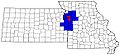 Kansas city metro counties.jpg 579 × 263; 34 KB
-
 KC metro map.svg 331 × 148; 64 KB
-
 Manhattan Micropolitan Area.png 567 × 308; 19 KB
-
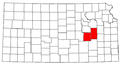
 Salina Micropolitan Area.png 567 × 308; 18 KB
-
 Salina Micropolitan Area.svg 6,607 × 3,388; 27 KB
-
 Topeka Metropolitan Area.png 567 × 308; 19 KB
-
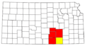 Wichita-Winfield CSA.png 567 × 308; 18 KB


