Category:Maps of cities in Portugal
Countries of Europe: Austria · Azerbaijan‡ · Belarus · Bosnia and Herzegovina · Bulgaria · Croatia · Czech Republic · Denmark · Estonia · Finland · France‡ · Georgia‡ · Germany · Greece · Hungary · Iceland · Italy · Kazakhstan‡ · Latvia · Lithuania · Moldova · Montenegro · Netherlands‡ · North Macedonia · Norway · Poland · Portugal‡ · Romania · Russia‡ · Slovakia · Spain‡ · Sweden · Switzerland · Turkey‡ · Ukraine · United Kingdom
Limited recognition: Abkhazia‡ · Kosovo · South Ossetia‡
‡: partly located in Europe
Limited recognition: Abkhazia‡ · Kosovo · South Ossetia‡
‡: partly located in Europe
Subcategories
This category has the following 61 subcategories, out of 61 total.
A
B
C
E
F
- Maps of Fátima (2 F)
G
H
L
M
- Maps of Porto Santo (24 F)
O
P
R
S
- Maps of Sacavém (10 F)
- Maps of São João da Madeira (5 F)
T
V
Media in category "Maps of cities in Portugal"
The following 8 files are in this category, out of 8 total.
-
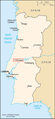 278px-Po-map fatima.png 278 × 599; 57 KB
-
 Cidades de Portugal URAU.jpg 2,480 × 3,508; 1.05 MB
-
 Escurquela location.png 286 × 551; 33 KB
-
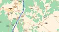
 Freguesiae Sancti Thyrsi anno 2013.PNG 700 × 664; 140 KB
-
 Mapa das cidades de Portugal.jpg 2,480 × 3,508; 640 KB
-
 Pds.png 119 × 214; 2 KB
-
 Plan albardo.JPG 684 × 378; 32 KB
-
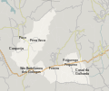 São Bartolomeu dos Galegos paroisse map.svg 1,583 × 1,331; 571 KB


