Category:Maps of civil parishes in North Yorkshire
Media in category "Maps of civil parishes in North Yorkshire"
The following 90 files are in this category, out of 90 total.
-
 Ainderby Miers with Holtby UK parish locator map.svg 1,425 × 1,037; 4.3 MB
-
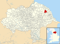
 Aislaby, Scarborough UK parish locator map.svg 1,425 × 1,037; 4.3 MB
-
 Barnby, North Yorkshire UK parish locator map.svg 1,425 × 1,037; 4.3 MB
-
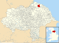
 Borrowby, Scarborough UK parish locator map.svg 1,425 × 1,037; 4.3 MB
-
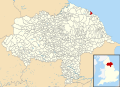
 Brompton, Scarborough UK parish locator map.svg 1,425 × 1,037; 4.3 MB
-
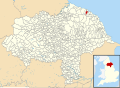
 Broxa-cum-Troutsdale UK parish locator map.svg 1,425 × 1,037; 4.3 MB
-
 Burniston UK parish locator map.svg 1,425 × 1,037; 4.3 MB
-
 Burton-cum-Walden UK parish locator map.svg 1,425 × 1,037; 4.3 MB
-
 Cayton UK parish locator map.svg 1,425 × 1,037; 4.3 MB
-
 Clapham cum Newby UK parish locator map.svg 1,425 × 1,037; 4.3 MB
-
 Cleveland UK parish map (blank).svg 1,425 × 1,034; 922 KB
-
 Cloughton UK parish locator map.svg 1,425 × 1,037; 4.3 MB
-
 Common to Fylingdales and Hawsker-cum-Stainsacre UK parish locator map.svg 1,425 × 1,037; 4.3 MB
-
 Commondale UK parish locator map.svg 1,425 × 1,037; 4.3 MB
-
 Danby, North Yorkshire UK parish locator map.svg 1,425 × 1,037; 4.3 MB
-
 Darncombe-cum-Langdale End UK parish locator map.svg 1,425 × 1,037; 4.3 MB
-
 East Ayton UK parish locator map.svg 1,425 × 1,037; 4.3 MB
-
 Eastfield, Scarborough UK parish locator map.svg 1,425 × 1,037; 4.3 MB
-
 Egton UK parish locator map.svg 1,425 × 1,037; 4.3 MB
-
 Eldmire with Crakehill UK parish locator map.svg 1,425 × 1,037; 4.3 MB
-
 Ellerby, North Yorkshire UK parish locator map.svg 1,425 × 1,037; 4.3 MB
-
 Embsay with Eastby UK parish map.svg 1,425 × 1,037; 4.3 MB
-
 Eskdaleside cum Ugglebarnby UK parish locator map.svg 1,425 × 1,037; 4.3 MB
-
 Exelby, Leeming and Londonderry UK parish locator map.svg 1,425 × 1,037; 4.3 MB
-
 Filey UK parish locator map.svg 1,425 × 1,037; 4.3 MB
-
 Folkton UK parish locator map.svg 1,425 × 1,037; 4.3 MB
-
 Fylingdales plus common UK parish locator map.svg 1,425 × 1,037; 4.3 MB
-
 Fylingdales UK parish locator map.svg 1,425 × 1,037; 4.3 MB
-
 Glaisdale UK parish locator map.svg 1,425 × 1,037; 4.3 MB
-
 Goathland UK parish locator map.svg 1,425 × 1,037; 4.3 MB
-
 Gristhorpe UK parish locator map.svg 1,425 × 1,037; 4.3 MB
-
 Grosmont UK parish locator map.svg 1,425 × 1,037; 4.3 MB
-
 Hackness UK parish locator map.svg 1,425 × 1,037; 4.3 MB
-
 Harwood Dale UK parish locator map.svg 1,425 × 1,037; 4.3 MB
-
 Hawsker-cum-Stainsacre plus common UK parish locator map.svg 1,425 × 1,037; 4.3 MB
-
 Hawsker-cum-Stainsacre UK parish locator map.svg 1,425 × 1,037; 4.3 MB
-
 Hazlewood with Storiths UK parish locator map.svg 1,425 × 1,037; 4.3 MB
-
 Hinderwell UK parish locator map.svg 1,425 × 1,037; 4.3 MB
-
 Hunmanby UK parish locator map.svg 1,425 × 1,037; 4.3 MB
-
 Hutton Bascel UK parish locator map.svg 1,425 × 1,037; 4.3 MB
-
 Hutton Mulgrave UK parish locator map.svg 1,425 × 1,037; 4.3 MB
-
 Irton UK parish locator map.svg 1,425 × 1,037; 4.3 MB
-
 Kettlewell with Starbotton UK parish locator map.svg 1,425 × 1,037; 4.3 MB
-
 Kirkby Fleetham with Fencote UK parish location map.svg 1,425 × 1,037; 4.3 MB
-
 Kirklington cum Upsland UK parish locator map.svg 1,425 × 1,037; 4.3 MB
-
 Landmoth-cum-Catto UK parish locator map.svg 1,425 × 1,037; 4.3 MB
-
 Lebberston UK parish locator map.svg 1,425 × 1,037; 4.3 MB
-
 Lockwood, North Yorkshire UK parish locator map.svg 1,425 × 1,037; 4.3 MB
-
 Lythe UK parish locator map.svg 1,425 × 1,037; 4.3 MB
-
 Malham Moor UK parish locator map.svg 1,425 × 1,037; 4.3 MB
-
 Martons Both UK parish locator map.svg 1,425 × 1,037; 4.3 MB
-
 Mickleby UK parish locator map.svg 1,425 × 1,037; 4.3 MB
-
 Mina de carbón Kellingley.png 440 × 320; 158 KB
-
 Muston UK parish locator map.svg 1,425 × 1,037; 4.3 MB
-
 Newby and Scalby UK parish locator map.svg 1,425 × 1,037; 4.3 MB
-
 Newholm-cum-Dunsley UK parish locator map.svg 1,425 × 1,037; 4.3 MB
-
 Newsham with Breckenbrough UK parish locator map.svg 1,425 × 1,037; 4.3 MB
-
 Newton Mulgrave UK parish locator map.svg 1,425 × 1,037; 4.3 MB
-
 North Stainley with Sleningford UK parish locator map.svg 1,425 × 1,037; 4.3 MB
-
 North Yorkshire UK parish map (blank).svg 1,425 × 1,037; 4.3 MB
-
 Norwood, North Yorkshire UK parish locator map.svg 1,425 × 1,037; 4.3 MB
-
 Osgodby, Scarborough UK parish locator map.svg 1,425 × 1,037; 4.3 MB
-
 Rand Grange UK parish locator map.svg 1,425 × 1,037; 4.3 MB
-
 Reighton UK parish locator map.svg 1,425 × 1,037; 4.3 MB
-
 Roxby, North Yorkshire UK parish locator map.svg 1,425 × 1,037; 4.3 MB
-
 Scosthrop UK parish locator map.svg 1,425 × 1,037; 4.3 MB
-
 Seamer, Scarborough UK parish locator map.svg 1,425 × 1,037; 4.3 MB
-
 Silpho UK parish locator map.svg 1,425 × 1,037; 4.3 MB
-
 Skeeby UK parish locator map.svg 1,425 × 1,037; 4.3 MB
-
 Skutterskelfe UK parish locator map.svg 1,425 × 1,037; 4.3 MB
-
 Snainton UK parish locator map.svg 1,425 × 1,037; 4.3 MB
-
 Snape with Thorp UK parish locator map.svg 1,425 × 1,037; 4.3 MB
-
 Sneaton UK parish locator map.svg 1,425 × 1,037; 4.3 MB
-
 South Cowton UK parish locator map.svg 1,425 × 1,037; 4.3 MB
-
 Sowerby-under-Cotcliffe UK parish locator map.svg 1,425 × 1,037; 4.3 MB
-
 Stainton and Thornton UK parish locator map.svg 1,425 × 1,037; 4.3 MB
-
 Staintondale UK parish locator map.svg 1,425 × 1,037; 4.3 MB
-
 Stirton with Thorlby UK parish locator map.svg 1,425 × 1,037; 4.3 MB
-
 Strensall with Towthorpe UK parish locator map.svg 1,425 × 1,037; 4.3 MB
-
 Suffield-cum-Everley UK parish locator map.svg 1,425 × 1,037; 4.3 MB
-
 Swainby with Allerthorpe UK parish locator map.svg 1,425 × 1,037; 4.3 MB
-
 Thornbrough UK parish locator map.svg 1,425 × 1,037; 4.3 MB
-
 Ugthorpe UK parish locator map.svg 1,425 × 1,037; 4.3 MB
-
 Warsill UK parish locator map.svg 1,425 × 1,037; 4.3 MB
-
 West Ayton UK parish locator map.svg 1,425 × 1,037; 4.3 MB
-
 Westerdale UK parish locator map.svg 1,425 × 1,037; 4.3 MB
-
 Whitby UK parish locator map.svg 1,425 × 1,037; 4.3 MB
-
 Wildon Grange UK parish locator map.svg 1,425 × 1,037; 4.3 MB
-
 Winton, Stank and Hallikeld UK parish locator map.svg 1,425 × 1,037; 4.3 MB
-
 Wykeham, Scarborough UK parish locator map.svg 1,425 × 1,037; 4.3 MB


.svg)
.svg)