Category:Maps of counties of medieval Bosnian state
Subcategories
This category has the following 2 subcategories, out of 2 total.
M
- Maps of Hum (12 F)
Media in category "Maps of counties of medieval Bosnian state"
The following 9 files are in this category, out of 9 total.
-
 Bosnia around 1412-es.svg 1,896 × 1,655; 862 KB
-
 Bosnia around 1412-sh.png 884 × 826; 113 KB
-
 Bosnia around 1412-sr.png 884 × 826; 110 KB
-
 Bosnia around 1412.png 884 × 826; 113 KB
-
 Bosnia during King Tvrtko I, V. Ćorović.jpg 984 × 845; 196 KB
-
 Historical regions of Bosnia and Herzegovina.svg 1,063 × 1,014; 7.75 MB
-
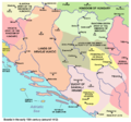
 Realm of Hrvoje Vukčić Hrvatinić.png 2,230 × 1,944; 188 KB
-
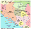
 Realms of Hrvatinići.png 2,230 × 1,944; 222 KB
-
 Regnum Sclavorum 754 AD.PNG 660 × 539; 530 KB


