Category:Maps of districts of the Western Cape
Media in category "Maps of districts of the Western Cape"
The following 17 files are in this category, out of 17 total.
-
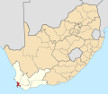 Map of South Africa with Cape Town highlighted (2016).svg 809 × 709; 716 KB
-
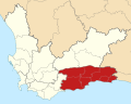
 Map of the Western Cape with Cape Town highlighted (2016).svg 849 × 676; 478 KB
-
 Map of South Africa with Cape Winelands highlighted (2016).svg 809 × 709; 719 KB
-

-
 Map of the Western Cape with Cape Winelands highlighted (2016).svg 849 × 676; 477 KB
-
 Map of South Africa with Central Karoo highlighted (2016).svg 809 × 709; 720 KB
-

-
 Map of the Western Cape with Central Karoo highlighted (2016).svg 849 × 676; 475 KB
-
 Map of South Africa with Garden Route highlighted (2016).svg 809 × 709; 722 KB
-
 Map of the Eden district with local municipalities labelled (2011).svg 1,133 × 512; 227 KB
-
 Map of the Western Cape with Garden Route highlighted (2016).svg 849 × 676; 490 KB
-
 Map of South Africa with Overberg highlighted (2016).svg 809 × 709; 721 KB
-

-
 Map of the Western Cape with Overberg highlighted (2016).svg 849 × 676; 488 KB
-
 Map of South Africa with West Coast highlighted (2016).svg 809 × 709; 731 KB
-
 Map of the West Coast district with local municipalities labelled (2011).svg 541 × 1,068; 256 KB
-
 Map of the Western Cape with West Coast highlighted (2016).svg 849 × 676; 509 KB
.svg)
.svg)
.svg)
.svg)
.svg)
.svg)
.svg)
.svg)
.svg)
.svg)
.svg)
.svg)
.svg)
.svg)
.svg)
.svg)
.svg)