Category:Maps of earthquakes in the United States
Countries of the Americas: Argentina · Bolivia · Brazil · Canada · Chile · Colombia · Costa Rica · Ecuador · El Salvador · Guatemala · Haiti · Honduras · Jamaica · Mexico · Nicaragua · Panama · Peru · United States of America · Venezuela
Other areas: Puerto Rico · South Georgia and the South Sandwich Islands
Other areas: Puerto Rico · South Georgia and the South Sandwich Islands
Subcategories
This category has the following 4 subcategories, out of 4 total.
*
Media in category "Maps of earthquakes in the United States"
The following 38 files are in this category, out of 38 total.
-
 1872 North Cascades Isoseismal Map.png 1,464 × 1,544; 508 KB
-
 1887 Sonora earthquake fault map.png 448 × 674; 234 KB
-
 1936 State Line earthquake isoseismal map.png 769 × 813; 228 KB
-
 1940 12 20 isoseismal map.PNG 646 × 531; 59 KB
-
 1944 Cornwall Massena Isoseismal Map.png 651 × 530; 124 KB
-
 2008 West Salem Earthquake.jpg 412 × 491; 31 KB
-
 2014 pga2pct50yrs (vector).svg 990 × 765; 6.6 MB
-
 2014 pga2pct50yrs.pdf 1,650 × 1,275; 1.9 MB
-
 273 of 'Eclectic Physical Geography' (11199976765).jpg 2,066 × 1,312; 677 KB
-
 438 of 'Elementary Physical Geography' (11143430174).jpg 797 × 1,017; 246 KB
-
 Anim7 us.gif 514 × 630; 274 KB
-
 Cumulative induced seismicity.png 1,167 × 876; 260 KB
-
 Determining epicenter.png 2,231 × 1,522; 220 KB
-
 Earthquake (1968).jpg 394 × 360; 162 KB
-
 Earthquake map.jpeg 2,250 × 1,500; 958 KB
-
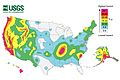
 East vs West Coast Earthquakes USGS.jpg 3,600 × 3,000; 1.75 MB
-
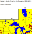 Eastern North America Earthquakes 1534-1994.PNG 363 × 394; 14 KB
-
 EQs 1900-2015 uswest.png 1,000 × 1,044; 1.9 MB
-
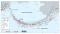 EQs 1900-2016 aleutian tsum.png 1,021 × 578; 994 KB
-
 Juan de Fuca Plate.jpg 720 × 538; 146 KB
-
 Kentucky Bend.png 902 × 768; 470 KB
-
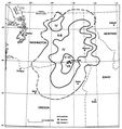
 Landkarte New Madrid Erdbeben.jpg 467 × 474; 42 KB
-
 Minnesota's earthquake epicenters.PNG 599 × 715; 97 KB
-
 New Madrid quakes.png 300 × 351; 82 KB
-
 New Madrid Seismic Zone activity 1974-2011.svg 747 × 788; 1.73 MB
-
 NMSZ Erdbeben.jpg 432 × 475; 81 KB
-
 NMSZ Vergleich.jpg 437 × 281; 37 KB
-
 New Madrid and Wabash seizmic zones-USGS mod.png 748 × 819; 430 KB
-
 New Madrid and Wabash seizmic zones-USGS.png 748 × 819; 467 KB
-
 NYC Seis.png 438 × 868; 101 KB
-
 OFR 99-311 fig48.gif 856 × 686; 110 KB
-
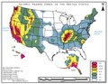 Seismic Hazard Zones In The United States.pdf 1,650 × 1,275; 455 KB
-
 Tacoma Earthquake-APR-29-1965.png 612 × 687; 74 KB
-
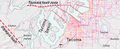 Tacoma fault zone.png 533 × 217; 195 KB
-
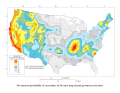
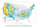
 USGS damage forecast for earthquakes in 2016.pdf 1,650 × 1,275; 1.43 MB
-
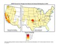
 USGS damage forecast for earthquakes in 2017.jpg 3,300 × 2,550; 1.62 MB
-

-
 USGS Shakemap - 1986 Chalfant Valley earthquake (1).jpg 1,024 × 1,313; 340 KB


.svg)
.jpg)
.jpg)


.jpg)


.jpg)