Category:Maps of electoral constituencies of Denmark
Media in category "Maps of electoral constituencies of Denmark"
The following 4 files are in this category, out of 4 total.
-
 Folketing Amtskredse1920.svg 2,834 × 2,126; 4.19 MB
-
 Folketing Amtskredse1971.svg 2,834 × 2,126; 8.22 MB
-
 Folketing Storkredse2007.svg 2,834 × 2,126; 5.5 MB
-
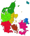 Folketingsvalgkredse.png 1,099 × 1,300; 189 KB


