Category:Maps of ethnic groups in China
Countries of Asia: Afghanistan · Armenia‡ · Azerbaijan‡ · Cambodia · People's Republic of China · Cyprus‡ · Georgia‡ · India · Iran · Iraq · Israel · Kazakhstan‡ · Kyrgyzstan · Malaysia · Myanmar · Nepal · Pakistan · Russia‡ · Syria · Thailand · Turkey‡ · Uzbekistan · Vietnam · Yemen
Limited recognition: Abkhazia‡ · Taiwan
‡: partly located in Asia
Limited recognition: Abkhazia‡ · Taiwan
‡: partly located in Asia
Media in category "Maps of ethnic groups in China"
The following 94 files are in this category, out of 94 total.
-
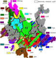 Autonomies in Yunnan.png 454 × 470; 54 KB
-
 Autonomy territories in Guizhou.png 579 × 500; 64 KB
-
 Bai autonomous prefectures and counties in China.png 2,677 × 2,183; 330 KB
-
 Baiyue(500bc).jpg 640 × 505; 186 KB
-
 Blang autonomous prefectures and counties in China.png 2,677 × 2,183; 329 KB
-
 Bonan autonomous prefectures and counties in China.png 2,677 × 2,183; 307 KB
-
 Bouyei autonomous prefectures and counties in China.png 2,677 × 2,183; 330 KB
-
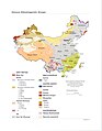 Chinese Ethnolinguistic Groups (China) - DPLA - fafd3a280531dbc897250d8bdc062064.jpg 2,554 × 3,276; 3.22 MB
-
 Dai autonomous prefectures and counties in China.png 2,677 × 2,183; 330 KB
-
 Daur autonomous prefectures and counties in China.png 2,677 × 2,183; 329 KB
-
 Derung autonomous prefectures and counties in China.png 2,677 × 2,183; 329 KB
-
 Dong autonomous prefectures and counties in China.png 2,677 × 2,183; 329 KB
-
 Dongxiang autonomous prefectures and counties in China.png 2,677 × 2,183; 329 KB
-
 Ethinic regional map of china.jpg 1,000 × 858; 92 KB
-
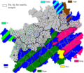
 Ethnic minorities areas in Guizhou-zh.png 579 × 500; 69 KB
-
 Ethnic minorities areas in Guizhou.png 579 × 500; 27 KB
-
 Ethnic minorities areas in Yunnan-zh.png 454 × 470; 65 KB
-
 Ethnic minorities areas in Yunnan.png 454 × 470; 55 KB
-
 Ethnic townships in Bijie.png 752 × 606; 92 KB
-
 Ethnic townships in Liupanshui.png 615 × 683; 72 KB
-
 Ethnic townships in Sentral Sichuan Yaan and Garze.png 813 × 689; 94 KB
-
 Ethnic townships in Sichuan Mianyang.png 541 × 487; 38 KB
-
 Ethnic townships in South Sichuan Yibin and Luzhou.png 835 × 515; 86 KB
-
 Ethnic townships in South-Eastern Hunan.png 852 × 503; 82 KB
-
 Ethnic townships in Yunnan Qujing.png 691 × 685; 82 KB
-
 Ethnic townships in Yunnan Zhaotong-Zhenxiong.png 641 × 487; 59 KB
-
 Ethnic townships in Yunnan, Sichuan, Guizhou.png 935 × 660; 91 KB
-
 Ethnic Yi.png 624 × 732; 50 KB
-
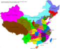 Ethno-linguistic based administrative division map of China.png 2,677 × 2,183; 544 KB
-
 Ethno-linguistic based on roughly distribution map of China.png 4,725 × 4,725; 1.15 MB
-
 Ethno-linguistic based regions of China.png 2,677 × 2,183; 470 KB
-
 Evenk autonomous prefectures and counties in China.png 2,677 × 2,183; 329 KB
-
 Gelao autonomous prefectures and counties in China.png 2,677 × 2,183; 329 KB
-
 Guangximap03.png 3,000 × 2,041; 463 KB
-
 GuangximapRT.png 3,000 × 2,041; 470 KB
-
 Hani autonomous prefectures and counties in China.png 2,677 × 2,183; 330 KB
-
 Hui autonomous prefectures and counties in China..png 2,677 × 2,183; 332 KB
-
 Jingpo autonomous prefectures and counties in China.png 2,677 × 2,183; 329 KB
-
 Kam-Sui autonomous prefectures and counties in China.png 2,677 × 2,183; 330 KB
-
 Kam-Sui people.png 1,526 × 926; 157 KB
-
 Kazakh autonomous prefectures and counties in China.png 2,677 × 2,183; 332 KB
-
 Korean autonomous prefectures and counties in China.png 2,677 × 2,183; 329 KB
-
 Kyrgyz autonomous prefectures and counties in China.png 2,677 × 2,183; 329 KB
-
 Lahu autonomous prefectures and counties in China.png 2,677 × 2,183; 329 KB
-
 Li autonomous prefectures and counties in China.png 2,677 × 2,183; 329 KB
-
 Lisu autonomous prefectures and counties in China.png 2,677 × 2,183; 330 KB
-
 Manchu autonomous prefectures and counties in China.png 2,677 × 2,183; 330 KB
-
 Manchu autonomous regions in Hebei.png 480 × 617; 54 KB
-
 Manchu autonomous regions in Jilin.png 606 × 486; 42 KB
-
 Manchu autonomous regions in Liaoning.png 503 × 468; 43 KB
-
 Manchuria "Manchuko" Number of Koreans - DPLA - fd7dad51ca66ec61d78014846c64505a.jpg 4,776 × 5,290; 3.18 MB
-
 Maonan autonomous prefectures and counties in China.png 2,677 × 2,183; 329 KB
-
 Mapa China.svg 290 × 234; 152 KB
-
 Miao autonomous prefectures and counties in China.png 2,677 × 2,183; 332 KB
-
 Mongol autonomous prefectures and counties in China.png 2,677 × 2,183; 340 KB
-
 Mulao autonomous prefectures and counties in China.png 2,677 × 2,183; 329 KB
-
 Nakhi autonomous prefectures and counties in China.png 2,677 × 2,183; 307 KB
-
 Nu autonomous prefectures and counties in China.png 2,677 × 2,183; 329 KB
-
 Oroqen autonomous prefectures and counties in China.png 2,677 × 2,183; 330 KB
-
 Percent of manchu in counties of China.png 1,262 × 645; 72 KB
-
 Pourcentage de han.png 6,804 × 4,937; 498 KB
-
 Pumi autonomous prefectures and counties in China.png 2,677 × 2,183; 329 KB
-
 Qiang autonomous prefectures and counties in China.png 2,677 × 2,183; 330 KB
-
 Salar autonomous prefectures and counties in China.png 2,677 × 2,183; 329 KB
-
 She autonomous prefectures and counties in China.png 2,677 × 2,183; 329 KB
-
 She ethnic county, townships and towns in Zhejiang.png 497 × 500; 44 KB
-
 She ethnic townships in Fujian.png 440 × 500; 44 KB
-
 She ethnic townships in Jiangxi.png 397 × 500; 39 KB
-
 Srovnání rozložení menšin.jpg 1,917 × 873; 217 KB
-
 Sui autonomous prefectures and counties in China.png 2,677 × 2,183; 329 KB
-
 Tajik autonomous prefectures and counties in China.png 2,677 × 2,183; 329 KB
-
 Tibetan autonomous prefectures and counties in China..png 2,677 × 2,183; 337 KB
-
 Tibetan distribution in China (1967).svg 2,677 × 2,183; 696 KB
-
 TNZB1.png 3,000 × 2,122; 1.21 MB
-
 TNZB2.png 3,511 × 2,484; 797 KB
-
 TNZM.png 3,000 × 1,904; 318 KB
-
 TNZMen.png 3,000 × 1,904; 320 KB
-
 Tu autonomous prefectures and counties in China.png 2,677 × 2,183; 329 KB
-
 Tujia autonomous prefectures and counties in China.png 2,677 × 2,183; 330 KB
-
 Tujia distribution density.png 1,334 × 922; 139 KB
-
 Uyghur autonomous prefectures and counties in China..png 2,677 × 2,183; 354 KB
-
 Wa autonomous prefectures and counties in China.png 2,677 × 2,183; 329 KB
-
 Xibe autonomous prefectures and counties in China.png 2,677 × 2,183; 329 KB
-
 Xinjiang County-Level Ethnicity Map (2018 data).svg 6,397 × 3,324; 4.71 MB
-
 Xinjiang ethnic group by county 2019.svg 737 × 495; 2.12 MB
-
 Xinjiang nationalities by prefecture 2000.png 1,474 × 1,219; 129 KB
-
 Yao autonomous prefectures and counties in China.png 2,677 × 2,183; 329 KB
-
 Yao distribution China.png 2,328 × 1,344; 269 KB
-
 Yi autonomous prefectures and counties in China.png 2,677 × 2,183; 333 KB
-
 Yugur autonomous prefectures and counties in China.png 2,677 × 2,183; 329 KB
-
 Zhuang And Bouyei Map.png 4,953 × 3,052; 1.87 MB
-
 Zhuang autonomous prefectures and counties in China..png 2,677 × 2,183; 333 KB
-
 Китай.jpg 1,521 × 1,380; 193 KB
-
 Процент китайцев в КНР.png 3,044 × 2,740; 425 KB


.jpg)


_-_DPLA_-_fafd3a280531dbc897250d8bdc062064.jpg)


.svg)


.svg)


