Category:Maps of forests in Pyrénées-Orientales
Departments of Metropolitan France: Ain [01] · Aisne [02] · Allier [03] · Alpes-de-Haute-Provence [04] · Hautes-Alpes [05] · Alpes-Maritimes [06] · Ardèche [07] · Ardennes [08] · Ariège [09] · Aube [10] · Aude [11] · Aveyron [12] · Bouches-du-Rhône [13] · Calvados [14] · Cantal [15] · Charente [16] · Charente-Maritime [17] · Cher [18] · Corrèze [19] · Corse-du-Sud [2A]† · Haute-Corse [2B]† · Côte-d’Or [21] · Côtes-d'Armor [22] · Creuse [23] · Dordogne [24] · Doubs [25] · Drôme [26] · Eure [27] · Eure-et-Loir [28] · Finistère [29] · Gard [30] · Haute-Garonne [31] · Gers [32] · Gironde [33] · Hérault [34] · Ille-et-Vilaine [35] · Indre [36] · Indre-et-Loire [37] · Isère [38] · Jura [39] · Landes [40] · Loir-et-Cher [41] · Loire [42] · Haute-Loire [43] · Loire-Atlantique [44] · Loiret [45] · Lot [46] · Lot-et-Garonne [47] · Lozère [48] · Maine-et-Loire [49] · Manche [50] · Marne [51] · Haute-Marne [52] · Mayenne [53] · Meurthe-et-Moselle [54] · Meuse [55] · Morbihan [56] · Moselle [57] · Nièvre [58] · Nord [59] · Oise [60] · Orne [61] · Pas-de-Calais [62] · Puy-de-Dôme [63] · Pyrénées-Atlantiques [64] · Hautes-Pyrénées [65] · Pyrénées-Orientales [66] · Bas-Rhin [67] · Haut-Rhin [68] · Rhône [69D]‡ · Haute-Saône [70] · Saône-et-Loire [71] · Sarthe [72] · Savoie [73] · Haute-Savoie [74] · Seine-Maritime [76] · Seine-et-Marne [77] · Yvelines [78] · Deux-Sèvres [79] · Somme [80] · Tarn [81] · Tarn-et-Garonne [82] · Var [83] · Vaucluse [84] · Vendée [85] · Vienne [86] · Haute-Vienne [87] · Vosges [88] · Yonne [89] · Territoire de Belfort [90] · Essonne [91] · Hauts-de-Seine [92] · Seine-Saint-Denis [93] · Val-de-Marne [94] · Val-d'Oise [95]
Subcategories
This category has only the following subcategory.
Media in category "Maps of forests in Pyrénées-Orientales"
The following 47 files are in this category, out of 47 total.
-
 66001-L'Albère-Sols.png 3,270 × 2,598; 1.38 MB
-
 66003-Amélie-les-Bains-Palalda-Sols.png 3,270 × 2,598; 2.56 MB
-
 66004-Les Angles-Sols.png 3,270 × 2,598; 1.58 MB
-
 66009-Arles-sur-Tech-Sols.png 3,270 × 2,598; 2.32 MB
-
 66010-Ayguatébia-Talau-Sols.png 3,270 × 2,598; 1.79 MB
-
 66018-La Bastide-Sols.png 3,270 × 2,598; 1.33 MB
-
 66020-Bolquère-Sols.png 3,270 × 2,598; 2.39 MB
-
 66023-Bouleternère-Sols.png 3,270 × 2,598; 1.5 MB
-
 66029-Caixas-Sols.png 3,270 × 2,598; 1.75 MB
-
 66032-Calmeilles-Sols.png 3,270 × 2,598; 1.46 MB
-
 66039-Caramany-Sols.png 3,270 × 2,598; 1.49 MB
-
 66040-Casefabre-Sols.png 3,270 × 2,598; 1.1 MB
-
 66054-Conat-Sols.png 3,270 × 2,598; 1.06 MB
-
 66060-Corsavy-Sols.png 3,270 × 2,598; 1.7 MB
-
 66061-Coustouges-Sols.png 3,270 × 2,598; 1,019 KB
-
 66063-Les Cluses-Sols.png 3,270 × 2,598; 1.81 MB
-
 66068-Escaro-Sols.png 3,270 × 2,598; 1.38 MB
-
 66090-Jujols-Sols.png 3,270 × 2,598; 985 KB
-
 66091-Lamanère-Sols.png 3,270 × 2,598; 1.19 MB
-
 66095-Latour-de-Carol-Sols.png 3,270 × 2,598; 1.48 MB
-
 66098-La Llagonne-Sols.png 3,270 × 2,598; 2.34 MB
-
 66112-Montauriol-Sols.png 3,270 × 2,598; 1.43 MB
-
 66113-Montbolo-Sols.png 3,270 × 2,598; 1.31 MB
-
 66116-Montferrer-Sols.png 3,270 × 2,598; 1.78 MB
-
 66117-Mont-Louis-Sols.png 3,270 × 2,598; 1.41 MB
-
 66126-Oms-Sols.png 3,270 × 2,598; 1.92 MB
-
 66139-Pézilla-de-Conflent-Sols.png 3,270 × 2,598; 1.03 MB
-
 66142-Planès-Sols.png 3,270 × 2,598; 1.61 MB
-
 66153-Prunet-et-Belpuig-Sols.png 3,270 × 2,598; 1.55 MB
-
 66155-Py-Sols.png 3,270 × 2,598; 1.42 MB
-
 66156-Rabouillet-Sols.png 3,270 × 2,598; 1.11 MB
-
 66157-Railleu-Sols.png 3,270 × 2,598; 1.04 MB
-
 66159-Réal-Sols.png 3,270 × 2,598; 1.08 MB
-
 66162-Rigarda-Sols.png 3,270 × 2,598; 1.53 MB
-
 66169-Saint-Arnac-Sols.png 3,270 × 2,598; 1.21 MB
-
 66179-Saint-Laurent-de-Cerdans-Sols.png 3,270 × 2,598; 1.63 MB
-
 66185-Saint-Michel-de-Llotes-Sols.png 3,270 × 2,598; 1.33 MB
-
 66196-Sorède-Sols.png 3,270 × 2,598; 2.92 MB
-
 66199-Taillet-Sols.png 3,270 × 2,598; 1 MB
-
 66209-Thuès-Entre-Valls-Sols.png 3,270 × 2,598; 1.12 MB
-
 66216-Trilla-Sols.png 3,270 × 2,598; 936 KB
-
 66219-Urbanya-Sols.png 3,270 × 2,598; 861 KB
-
 66220-Valcebollère-Sols.png 3,270 × 2,598; 1.32 MB
-
 66221-Valmanya-Sols.png 3,270 × 2,598; 1.07 MB
-
 66232-Vira-Sols.png 3,270 × 2,598; 1,002 KB
-
 66234-Le Vivier-Sols.png 3,270 × 2,598; 1.29 MB
-
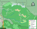
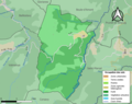
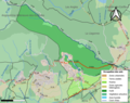
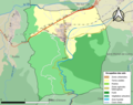
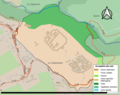
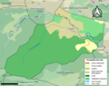
 Périmètre RNN Forêt de la Massane rnn6.png 1,350 × 900; 1,000 KB


