Category:Maps of green spaces in Paris
Subcategories
This category has the following 11 subcategories, out of 11 total.
B
- Maps of the Bois de Boulogne (41 F)
- Maps of Buttes Chaumont (11 F)
C
L
P
T
- Maps of the Jardin des Tuileries (30 F)
V
Media in category "Maps of green spaces in Paris"
The following 34 files are in this category, out of 34 total.
-
 Green spaces in Paris, 2012.svg 1,371 × 893; 2.02 MB
-
 Map of green spaces in Paris, 2012.svg 1,371 × 893; 3.56 MB
-
 Simplified map of green spaces in Paris, 2012.svg 512 × 329; 27 KB
-
 Parc de Bercy, Paris - OSM 2021.svg 2,050 × 820; 291 KB
-
 Champ-de-Mars, Paris - OSM 2020.svg 1,920 × 790; 462 KB
-
 Cimetière de Charonne.svg 785 × 705; 922 KB
-
 Cimetière du Montparnasse - OpenStreetMap.svg 805 × 868; 1.66 MB
-
 Cité internationale universitaire de Paris - OSM 2020.svg 1,900 × 840; 572 KB
-
 Clichy-Batignolles - OSM 2021.svg 1,720 × 1,080; 773 KB
-
 Green spaces in Paris - OSM 2020.svg 4,660 × 2,720; 2.83 MB
-
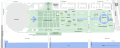
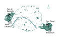
 Jardin d'acclimatation (Paris) location map.svg 888 × 258; 1.05 MB
-
 Jardin du Ranelagh - OSM 2020 01.svg 1,400 × 1,400; 432 KB
-
 Jardin du Ranelagh - OSM 2020 02.svg 1,100 × 1,100; 419 KB
-
 Jardins d'immeubles de la Porte de Vincennes - OSM 2017.svg 512 × 431; 5 KB
-
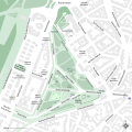
 Jardins du Trocadéro - OSM 2021.svg 1,483 × 1,173; 516 KB
-
 Les Espaces verts existant dans Paris (1980) - BHVP.jpg 4,805 × 3,205; 1.96 MB
-
 Les Halles - OpenStreetMap 2020.svg 2,000 × 1,000; 230 KB
-
 Les Invalides - OpenStreetMap 1.svg 566 × 1,141; 2 MB
-
 Map of Parc Montsouris - OpenStreetMap.svg 758 × 766; 1.35 MB
-
 MNHN 1892.png 2,751 × 2,799; 3.27 MB
-
 Parc André Citroën - OpenStreetMap 1.svg 924 × 970; 1.8 MB
-
 Parc André-Citroën - OSM 2020.svg 1,200 × 800; 134 KB
-
 Parc Georges-Brassens - OSM 2021.svg 1,900 × 1,700; 312 KB
-
 Parc Monceau - OpenStreetMap 1.svg 703 × 458; 888 KB
-
 Parc Montsouris - OSM 2020 01.svg 1,290 × 1,300; 842 KB
-
 Parc Montsouris - OSM 2020 02.svg 1,967 × 1,967; 1,000 KB
-
 Paris department land cover location map.svg 1,371 × 893; 6.75 MB
-
 Paris department land cover map, January 2012.svg 1,371 × 893; 14.95 MB
-
 Paris, Place des Vosges - OpenStreetMap 2017.svg 512 × 512; 23 KB
-
 Paris, Place des Vosges - OpenStreetMap.svg 366 × 350; 516 KB
-
 Place du Trocadéro - OpenStreetMap 2020.svg 512 × 341; 602 KB
-
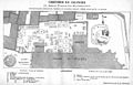 Plan du cimetière du Calvaire 01.jpeg 1,361 × 877; 525 KB
-
 Plan-localisation-jardin-botanique-paris.jpg 4,212 × 2,513; 1.15 MB
-
 Plan-localisation-jardin-botanique.jpg 5,298 × 3,381; 1.64 MB


_-_BHVP.jpg)


_location_map.svg)