Category:Maps of historic counties of England
Subcategories
This category has the following 9 subcategories, out of 9 total.
Media in category "Maps of historic counties of England"
The following 113 files are in this category, out of 113 total.
-
 1885-1918 Scarborough.png 351 × 280; 8 KB
-
 BedfordshireBrit5.PNG 625 × 569; 26 KB
-
 BedfordshireBrit5.png 625 × 569; 13 KB
-
 BerkshireBrit5.png 625 × 569; 13 KB
-
 BerwickshireBrit2.PNG 608 × 604; 20 KB
-
 BerwickshireBrit2.png 608 × 604; 15 KB
-
 BerwickshireBrit3.PNG 698 × 491; 28 KB
-
 CambridgeshireBrit5.png 625 × 569; 13 KB
-
 Central england counties 1851.png 935 × 478; 50 KB
-
 CheshireBrit3.PNG 698 × 491; 28 KB
-
 CheshireBrit5.PNG 625 × 569; 26 KB
-
 CheshireBrit5.png 625 × 569; 13 KB
-
 CornwallBrit5.png 625 × 569; 13 KB
-
 County of London, England.svg 1,108 × 1,345; 333 KB
-
 Cricket counties.svg 512 × 622; 276 KB
-
 Cumberland Brit Isles Sect 2.svg 915 × 841; 1,004 KB
-
 CumberlandBrit2.PNG 608 × 604; 20 KB
-
 CumberlandBrit2.png 608 × 604; 15 KB
-
 CumberlandBrit3.PNG 698 × 491; 19 KB
-
 CumberlandBrit3.png 698 × 491; 15 KB
-
 DerbyshireBrit5.PNG 625 × 569; 26 KB
-
 DerbyshireBrit5.png 625 × 569; 13 KB
-
 DevonBrit5.png 625 × 569; 13 KB
-
 Doomsday Book - Counties of England - 1086.png 502 × 462; 202 KB
-
 DorsetBrit5.PNG 625 × 569; 26 KB
-
 DorsetBrit5.png 625 × 569; 13 KB
-
 Durham Brit Isles Sect 2.svg 915 × 841; 1,004 KB
-
 DurhamBrit2.PNG 608 × 604; 20 KB
-
 DurhamBrit2.png 608 × 604; 15 KB
-
 DurhamBrit3.PNG 698 × 491; 19 KB
-
 DurhamBrit3.png 698 × 491; 15 KB
-
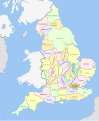
 England Admin Counties 1890-1965.png 2,625 × 3,256; 1.09 MB
-
 England Admin Counties 1965-1974.png 2,625 × 3,256; 1.09 MB
-
 England Administrative 1931 Unlabelled.png 21,000 × 26,010; 8.12 MB
-
 England Administrative 1931.jpg 5,300 × 6,512; 3.07 MB
-
 England and Wales 1961.png 1,410 × 1,743; 94 KB
-
 England and Wales 1964 tops.png 1,410 × 1,743; 158 KB
-
 England and Wales counties, 1972.svg 567 × 648; 1.08 MB
-
 England counties 1851 (multi-coloured).png 1,459 × 1,769; 42 KB
-
 England counties 1851 named.png 1,459 × 1,769; 166 KB
-
 England counties 1851 numbered.png 1,459 × 1,769; 146 KB
-
 England counties 1851.png 1,459 × 1,769; 101 KB
-
 England County Boroughs 1974.png 2,625 × 3,256; 1.12 MB
-
 England southern counties 1851.png 1,405 × 654; 68 KB
-
 England traditional counties numbered NS.svg 611 × 787; 128 KB
-
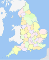
 England traditional counties.png 404 × 505; 71 KB
-
 England traditional counties.svg 611 × 787; 128 KB
-
 EnglandCeremonial1964.png 200 × 254; 26 KB
-
 EnglandNumbered1890.png 400 × 507; 79 KB
-
 EnglandNumbered1965.png 400 × 507; 78 KB
-
 EnglandNumbered1965CB.png 400 × 487; 81 KB
-
 EnglandTraditionalBlank.png 642 × 802; 10 KB
-
 EnglandTraditionalShires.png 642 × 802; 34 KB
-
 English administrative counties 1889 (numbered).svg 1,108 × 1,345; 370 KB
-
 English administrative counties 1965 (numbered).svg 1,108 × 1,345; 361 KB
-
 English counties 1851 (named).svg 1,108 × 1,345; 346 KB
-
 English counties 1851 (numbered).svg 1,108 × 1,345; 352 KB
-
 English counties 1851 with ridings.svg 1,108 × 1,345; 315 KB
-
 English counties 1851.svg 1,108 × 1,345; 315 KB
-
 English geographical counties 1889 (named).svg 1,108 × 1,345; 341 KB
-
 English geographical counties 1889 with ridings (numbered).svg 1,108 × 1,345; 357 KB
-
 English geographical counties 1889 with ridings.svg 1,108 × 1,345; 307 KB
-
 English geographical counties 1889.svg 1,108 × 1,345; 307 KB
-
 English geographical counties 1965 (named).svg 1,108 × 1,345; 342 KB
-
 English geographical counties 1965 with ridings.svg 1,108 × 1,345; 308 KB
-
 English geographical counties 1965.svg 1,108 × 1,345; 308 KB
-
 English heraldic visitations map.png 642 × 802; 88 KB
-
 EssexBrit5.GIF 625 × 569; 12 KB
-
 EssexBrit5.PNG 625 × 569; 26 KB
-
 GloucestershireBrit5.GIF 625 × 569; 12 KB
-
 GloucestershireBrit5.PNG 625 × 569; 26 KB
-
 HampshireBrit5.GIF 625 × 569; 12 KB
-
 HerefordshireBrit5.GIF 625 × 569; 12 KB
-
 HerefordshireBrit5.PNG 625 × 569; 26 KB
-
 Hertfordshire Administrative Map 1832.png 2,000 × 1,587; 404 KB
-
 HertfordshireBrit5.GIF 625 × 569; 12 KB
-
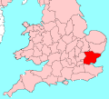
 Home Counties (1889 county borders).svg 430 × 345; 63 KB
-
 HuntingdonshireBrit5.GIF 625 × 569; 12 KB
-
 HuntingdonshireBrit5.PNG 625 × 569; 26 KB
-
 John Speed - Map of Cumberland - 1610 - 001.jpg 2,992 × 2,268; 3.29 MB
-
 KentBrit5.GIF 625 × 569; 12 KB
-
 LancashireBrit3.GIF 698 × 491; 14 KB
-
 LeicestershireBrit5.GIF 625 × 569; 12 KB
-
 LeicestershireBrit5.PNG 625 × 569; 26 KB
-
 LincolnshireBrit5.GIF 625 × 569; 12 KB
-
 LincolnshireBrit5.PNG 625 × 569; 26 KB
-
 MiddlesexBrit5.GIF 625 × 569; 12 KB
-
 NorfolkBrit5.GIF 625 × 569; 12 KB
-
 NorthamptonshireBrit5.GIF 625 × 569; 12 KB
-
 NorthamptonshireBrit5.PNG 625 × 569; 26 KB
-
 Northern counties 1851.png 758 × 827; 49 KB
-
 Northumberland Brit Isles Sect 2.svg 915 × 841; 1,004 KB
-
 NorthumberlandBrit2.GIF 608 × 604; 14 KB
-
 NorthumberlandBrit2.PNG 608 × 604; 20 KB
-
 NorthumberlandBrit3.GIF 698 × 491; 14 KB
-
 NorthumberlandBrit3.PNG 698 × 491; 19 KB
-
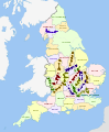
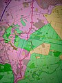 Nottinghamshire Lincolnshire Yorkshire exclaves.jpg 3,120 × 4,160; 4.48 MB
-
 NottinghamshireBrit5.GIF 625 × 569; 12 KB
-
 OxfordshireBrit5.GIF 625 × 569; 12 KB
-
 OxfordshireBrit5.PNG 625 × 569; 26 KB
-
 RutlandBrit5.GIF 625 × 569; 12 KB
-
 ShropshireBrit5.GIF 625 × 569; 12 KB
-
 ShropshireBrit5.PNG 625 × 569; 26 KB
-
 SomersetBrit5.GIF 625 × 569; 12 KB
-
 SomersetBrit5.PNG 625 × 569; 26 KB
-
 StaffordshireBrit5.GIF 625 × 569; 12 KB
-
 StaffordshireBrit5.PNG 625 × 569; 26 KB
-
 SuffolkBrit5.GIF 625 × 569; 12 KB
-
 SussexBrit5.GIF 625 × 569; 12 KB
-
 Traditionelle Grafschaften Englands 1086.png 642 × 802; 9 KB
-
 Westmorland Brit Isles Sect 2.svg 915 × 841; 1,004 KB
-
 Wiltshire exclaves east Berkshire.jpg 3,120 × 4,160; 4.16 MB
-
 Worcestershire's Hundreds (until 1844).png 1,074 × 1,024; 98 KB


.png)


.svg)
.svg)
.svg)
.svg)


.svg)
.svg)


.svg)


.svg)


.png)