Category:Maps of islands of Luzon
Media in category "Maps of islands of Luzon"
The following 10 files are in this category, out of 10 total.
-
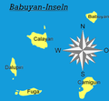 Babuyan-Islands.PNG 307 × 285; 27 KB
-
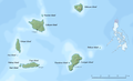 Babuyan islands en.png 1,205 × 731; 346 KB
-
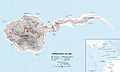 Map of Corregidor 1941.jpg 2,066 × 1,241; 368 KB
-
 Recapture of Corregidor 1945.jpg 2,056 × 1,456; 650 KB
-
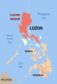 Ph locator map luzon.png 300 × 440; 20 KB
-
 Luzon Strait n7184.jpg 542 × 1,020; 77 KB
-
 Luzon-strait0010.jpg 800 × 637; 243 KB
-
 Ph locator map mindoro.png 300 × 440; 23 KB
-
 Ph locator romblon sibuyan.png 300 × 300; 7 KB
-
 TribalPhilippinesTraditionalRange.png 2,000 × 3,120; 208 KB


