Category:Maps of local municipalities of Mpumalanga
Media in category "Maps of local municipalities of Mpumalanga"
The following 17 files are in this category, out of 17 total.
-
 Map of Mpumalanga with Albert Luthuli highlighted (2016).svg 768 × 746; 345 KB
-
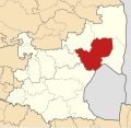
 Map of Mpumalanga with Bushbuckridge highlighted (2016).svg 768 × 746; 356 KB
-
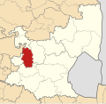
 Map of Mpumalanga with Dipaleseng highlighted (2016).svg 768 × 746; 356 KB
-
 Map of Mpumalanga with Dr JS Moroka highlighted (2016).svg 768 × 746; 343 KB
-
 Map of Mpumalanga with Emakhazeni highlighted (2016).svg 768 × 746; 346 KB
-
 Map of Mpumalanga with Emalahleni highlighted (2016).svg 768 × 746; 345 KB
-
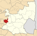
 Map of Mpumalanga with Govan Mbeki highlighted (2016).svg 768 × 746; 345 KB
-
 Map of Mpumalanga with Lekwa highlighted (2016).svg 768 × 746; 360 KB
-
 Map of Mpumalanga with Mbombela highlighted (2016).svg 768 × 746; 355 KB
-
 Map of Mpumalanga with Mkhondo highlighted (2016).svg 768 × 746; 356 KB
-
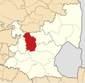
 Map of Mpumalanga with Msukaligwa highlighted (2016).svg 768 × 746; 349 KB
-
 Map of Mpumalanga with Nkomazi highlighted (2016).svg 768 × 746; 350 KB
-
 Map of Mpumalanga with Pixley ka Seme highlighted (2016).svg 768 × 746; 360 KB
-
 Map of Mpumalanga with Steve Tshwete highlighted (2016).svg 768 × 746; 350 KB
-
 Map of Mpumalanga with Thaba Chweu highlighted (2016).svg 768 × 746; 347 KB
-
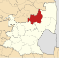
 Map of Mpumalanga with Thembisile Hani highlighted (2016).svg 768 × 746; 351 KB
-
 Map of Mpumalanga with Victor Khanye highlighted (2016).svg 768 × 746; 342 KB
.svg)
.svg)
.svg)
.svg)
.svg)
.svg)
.svg)
.svg)
.svg)
.svg)
.svg)
.svg)
.svg)
.svg)
.svg)
.svg)
.svg)