Category:Maps of municipalities in the district of Oberhasli old
Media in category "Maps of municipalities in the district of Oberhasli old"
The following 6 files are in this category, out of 6 total.
-
 Karte Gemeinde Gadmen.png 1,003 × 925; 191 KB
-
 Karte Gemeinde Guttannen.png 1,003 × 925; 192 KB
-
 Karte Gemeinde Hasliberg.png 1,003 × 925; 186 KB
-
 Karte Gemeinde Innertkirchen.png 1,003 × 925; 189 KB
-
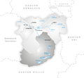
 Karte Gemeinde Meiringen.png 1,003 × 925; 186 KB
-
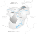
 Karte Gemeinde Schattenhalb.png 1,003 × 925; 187 KB


