Category:Maps of parts of Western Australia
Subcategories
This category has the following 6 subcategories, out of 6 total.
Media in category "Maps of parts of Western Australia"
The following 103 files are in this category, out of 103 total.
-
 3500 farms.jpg 556 × 363; 74 KB
-
 A Map of Bunuba Country.jpg 1,650 × 1,553; 226 KB
-
 Admiralty Chart No 1243 Cape Londonderry to Cape Voltaire, Australia, Published 1954.jpg 16,428 × 11,264; 51.07 MB
-
 Anne Beadell Highway v300.png 1,073 × 470; 177 KB
-
 Battye freycinet swanriver lg.jpg 355 × 500; 61 KB
-
 Brookton - Corrigin stations.JPG 2,599 × 764; 561 KB
-
 Buccaneer Archipelago, LT.svg 1,212 × 1,201; 435 KB
-
 Bunbury, Australie Occidentale.png 716 × 465; 159 KB
-
 Burrupmap.JPG 800 × 551; 54 KB
-
 Burrupmap.png 940 × 648; 41 KB
-
 Cape Leveque Road 0416.svg 751 × 781; 113 KB
-
 Carnac Island map de.png 1,280 × 1,747; 232 KB
-
 Carnac Island map de.svg 536 × 731; 59 KB
-
 Carnac Island map.png 1,280 × 1,747; 242 KB
-
 Carnac Island map.svg 536 × 731; 59 KB
-
 Collier Bay, Western Australia, LT.svg 800 × 592; 422 KB
-
 Colonie de la rivière Swan (Australie).png 2,190 × 1,577; 128 KB
-
 Coolgardie En.jpg 4,960 × 2,812; 6.88 MB
-
 Cue Australia.png 977 × 785; 174 KB
-
 Dampier Archipelago, LT.svg 1,873 × 1,181; 272 KB
-
 Distribution of P. occidentale in Western Australia.png 501 × 166; 13 KB
-
 Espérance1.JPG 854 × 548; 34 KB
-
 Exmouth Gulf, LT.svg 527 × 534; 448 KB
-
 Figure 1.1 (rgb).jpg 1,754 × 1,240; 1.5 MB
-
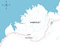 Fitzroy Crossing, Kimberley Region of Western Australia.jpg 1,280 × 1,005; 139 KB
-
 Gary Highway map 16.svg 358 × 640; 145 KB
-
 Gary Junction Road 0216 map.svg 1,320 × 544; 252 KB
-
 Gold mines Kalgoorlie 2.svg 542 × 665; 2.83 MB
-
 Gold mines Kalgoorlie Leonora (2).svg 712 × 1,109; 2.83 MB
-
 Gold mines Kalgoorlie Leonora.jpg 1,235 × 2,311; 149 KB
-
 Gold mines Kalgoorlie.jpg 1,239 × 1,462; 108 KB
-
 Gold mines Leonora 2.svg 712 × 327; 2.83 MB
-
 Gold mines Leonora.jpg 1,239 × 673; 57 KB
-
 Gold mines Meekathara Leinster 2.svg 2,287 × 1,426; 1.14 MB
-
 Gold mines Meekathara Leinster.jpg 1,718 × 1,855; 151 KB
-
 Goldfields colony.jpg 500 × 401; 60 KB
-
 Gorgon Barrow Island.png 558 × 447; 194 KB
-
 Great Central Road 0216.svg 781 × 462; 152 KB
-
 Kalumburu Road 0117.svg 480 × 572; 144 KB
-
 Karlamilyi National Park 0316.svg 563 × 432; 115 KB
-
 Kent County Western Australia (J Sands 1886).png 663 × 405; 513 KB
-
 Kununurra-town.png 878 × 613; 248 KB
-
 Lake Breaden 0317.svg 1,307 × 826; 127 KB
-
 Lake Carnegie WA 0217.svg 517 × 374; 248 KB
-
 Lake Darlot WA 0217.svg 1,315 × 814; 236 KB
-
 Lake Disappointment 0417.svg 1,149 × 828; 317 KB
-
 Lake Dora 0317.svg 1,054 × 825; 203 KB
-
 Lake Hopkins WA 0117.svg 517 × 532; 303 KB
-
 Lake Macdonald WA-NT.svg 438 × 411; 318 KB
-
 Lake Wells WA 0217.svg 480 × 381; 116 KB
-
 Latitude Hill (North Island, Houtman Abrolhos).svg 4,320 × 5,120; 109 KB
-
 Mallee En.jpg 4,960 × 3,001; 6.63 MB
-
 Map of King George Sound drawn using Paint.jpg 882 × 689; 33 KB
-
 Map of King Sound (Western Australia) in 1886.png 511 × 443; 291 KB
-
 Map of the Counties of West Australia (2).png 439 × 439; 349 KB
-
 Map of the Counties of West Australia 1886 (1).png 475 × 349; 339 KB
-
 Map of the Counties of Western Australia 1886 (3).png 476 × 320; 275 KB
-
 Map of West Toodyay, 1910, Cons 3868 item 395.jpg 5,231 × 3,999; 3 MB
-
 Margaret River wine region.jpg 515 × 290; 69 KB
-
 Menzies-town.png 594 × 827; 88 KB
-
 Mining Wiluna Leinster map.jpg 1,189 × 1,529; 119 KB
-
 Mtmelv.png 242 × 176; 7 KB
-
 Murtu aboriginal people lands.png 551 × 488; 11 KB
-
 Noongar regions map.svg 1,026 × 872; 181 KB
-
 North Island (Houtman Abrolhos).svg 4,320 × 5,120; 117 KB
-
 North West Cape (2051686081).jpg 2,048 × 1,536; 765 KB
-
 NW Australia 1885.jpg 1,263 × 1,396; 269 KB
-
 Outside Perth divisions by party 2016.png 900 × 1,065; 120 KB
-
 Outside Perth divisions overview 2016.png 900 × 1,065; 124 KB
-
 PeelHarvey.jpg 408 × 776; 81 KB
-
 Percival Lakes 0217.svg 1,538 × 1,029; 221 KB
-
 Perth divisions by party 2016.png 900 × 1,065; 143 KB
-
 Perth divisions overview 2016.png 900 × 1,065; 146 KB
-
 Pigeon Island (Houtman Abrolhos).svg 1,179 × 1,328; 62 KB
-
 Pintupi country.png 1,226 × 800; 247 KB
-
 Record Hill (North Island, Houtman Abrolhos).svg 4,320 × 5,120; 109 KB
-
 Ros 2.jpg 264 × 800; 45 KB
-
 Sandy Blight Junction Road v116.svg 600 × 760; 173 KB
-
 Serpentine Lakes 0217.svg 671 × 845; 107 KB
-
 Shark Bay fr.svg 1,042 × 1,460; 350 KB
-
 Shark Bay, lt.svg 945 × 1,227; 140 KB
-
 Shark Bay.gif 488 × 421; 9 KB
-
 Sign at Mundaring Weir 2006.jpg 2,160 × 1,540; 708 KB
-
 South Coast — Cape Leeuwin, Cape Chatham and Eclipse Isles.jpg 594 × 424; 45 KB
-
 South-west Commonwealth Marine Reserves Network map.jpg 600 × 377; 77 KB
-
 South-west Corner Commonwealth Marine Reserve.png 1,516 × 977; 81 KB
-
 Southwest Australia hotspot.png 582 × 450; 20 KB
-
 SunsetCoast1Map.jpg 640 × 400; 42 KB
-
 SWA Aridité.jpg 4,960 × 3,508; 2.55 MB
-
 SWA Bioclimats.jpg 4,960 × 3,508; 1.87 MB
-
 SWA Biorégions.jpg 4,960 × 3,508; 2.3 MB
-
 SWA Continentalité.jpg 4,960 × 3,508; 2.39 MB
-
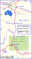
 SWAHighways.png 1,440 × 1,080; 316 KB
-
 Swan River Map.png 958 × 960; 34 KB
-
 Tharrgari aboriginal people lands.png 551 × 488; 9 KB
-
 The West Kimberley, National Heritage List boundaries, 1 September 2011.pdf 2,479 × 1,752; 1.1 MB
-
 VaranusIslandIncident locator.png 454 × 336; 172 KB
-
 WA survey.jpg 656 × 796; 196 KB
-
 WA Wheatbelt A4.jpg 4,055 × 5,086; 3.89 MB
-
 Western Australia cadastral divisions.png 800 × 1,012; 116 KB
-
 Western Brush Wallaby.jpg 1,620 × 997; 203 KB
-
 Western Quoll Range.JPG 1,283 × 994; 490 KB
-
 Yeo Lake 0317.svg 1,178 × 819; 204 KB


.png)


.jpg)


.svg)


.png)


.svg)


_in_1886.png)
.png)
.png)
.png)


.svg)
.jpg)


.svg)

.svg)


