Category:Maps of past tectonic plates
Media in category "Maps of past tectonic plates"
The following 133 files are in this category, out of 133 total.
-
 100 global.png 737 × 736; 109 KB
-
 220Ma Paleomap.svg 3,000 × 1,500; 154 KB
-
 230 Ma plate tectonic reconstruction.png 948 × 954; 174 KB
-
 237 Ma orogenies reconstruction.jpg 1,058 × 794; 107 KB
-
 237 Ma plate tectonic reconstruction.jpg 465 × 412; 43 KB
-
 249 global.png 766 × 771; 143 KB
-
 280 Ma plate tectonic reconstruction.png 563 × 596; 82 KB
-
 290 global.png 780 × 783; 133 KB
-
 380 Ma plate tectonic reconstruction.png 557 × 608; 76 KB
-
 Alfred Wegener - Pangaea.jpg 720 × 380; 131 KB
-
 Antieke kontinente.jpg 603 × 667; 126 KB
-
 Arabic-Snider-Pellegrini Wegener fossil map.png 577 × 443; 115 KB
-
 Astrobleme Europe.jpg 612 × 493; 159 KB
-
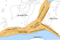
 Avalonia Baltica geologi.png 949 × 898; 737 KB
-
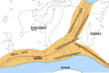
 Avalonia today.jpg 1,517 × 759; 240 KB
-
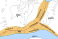
 Avalonia-480Ma.jpg 759 × 759; 78 KB
-
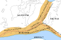
 AVALONIA.jpg 781 × 633; 108 KB
-
 AVALONIA.svg 784 × 367; 49 KB
-
 Avalonië-Devoon.svg 360 × 346; 12 KB
-
 Baltica 1100 Ma.png 1,497 × 815; 381 KB
-
 Baltica outline.png 1,497 × 815; 228 KB
-
 BeforeTheAtlantic.pdf 1,752 × 1,185; 458 KB
-
 BurbankRiverMap.jpg 3,508 × 1,120; 433 KB
-
 Caledonides CS.svg 630 × 421; 126 KB
-
 Caledonides DE.svg 630 × 421; 98 KB
-
 Caledonides EN.svg 630 × 421; 126 KB
-
 Caledonides FR.svg 630 × 421; 127 KB
-
 Caledonides Km.jpg 2,625 × 1,755; 1.4 MB
-
 Caledonides KM.png 2,625 × 1,755; 17.6 MB
-
 Caledonides KM.svg 512 × 342; 47 KB
-
 Caledonides NL.svg 630 × 421; 126 KB
-
 Cambrianmap.svg 320 × 210; 94 KB
-
 CAMP Magmatism in the context of Pangea.jpg 553 × 625; 40 KB
-
 CARNIAN EARTH.jpg 720 × 540; 126 KB
-
 Cratons West Gondwana and EAO v2.png 629 × 599; 157 KB
-
 Cratons West Gondwana and EAO.png 629 × 599; 153 KB
-
 Cratons West Gondwana IT.svg 745 × 710; 170 KB
-
 Cratons West Gondwana-es.svg 745 × 710; 196 KB
-
 Cratons West Gondwana.svg 745 × 710; 170 KB
-
 De Wegener Kontinente 018.jpg 712 × 1,200; 277 KB
-
 Eocene-Paleocene-circumpolar.svg 775 × 1,158; 226 KB
-
 Es-Laurasia-Gondwana.png 728 × 625; 110 KB
-
 Euramerica en.svg 831 × 594; 257 KB
-
 Europrobe - Avalonia Basement Europe.png 1,283 × 1,317; 53 KB
-
 Evolution of MTJ.JPG 1,141 × 418; 81 KB
-
 Fanerozoicobrasil1.png 3,462 × 2,294; 3.17 MB
-
 Fig2-5globes.gif 623 × 777; 59 KB
-

-
 Gondbreak.png 514 × 343; 13 KB
-
 Gondwana 420 Ma.png 807 × 791; 631 KB
-
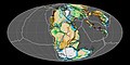
 Gondwana and Laurentia.png 2,048 × 2,048; 2.56 MB
-
 Gondwana Nederlandse versie.png 577 × 443; 114 KB
-
 Gondwana, China and Siberia.png 2,048 × 2,048; 2.13 MB
-
 Gondwana038ma hg.png 620 × 463; 77 KB
-
 Gondwana053Ma hg.png 620 × 463; 21 KB
-
 Gondwana065Ma hg.png 620 × 463; 78 KB
-
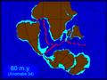 Gondwana080Ma hg.png 620 × 463; 78 KB
-
 Gondwana115Ma hg.png 620 × 463; 19 KB
-
 Hercynides CS.svg 550 × 370; 108 KB
-
 Hercynides DE.svg 550 × 370; 109 KB
-
 Hercynides EN.svg 550 × 370; 108 KB
-
 Hercynides IT.svg 550 × 370; 87 KB
-
 Hercynides Km.jpg 2,292 × 1,543; 835 KB
-
 Hercynides NL.svg 550 × 370; 108 KB
-
 India 71-0 Ma.gif 442 × 743; 104 KB
-
 Kimméria és a Tethys-öböl.jpg 766 × 1,755; 1.17 MB
-
 Kontinenternas vandringar Trias o Krita.PNG 845 × 397; 369 KB
-
 Kuunga2.jpg 1,000 × 785; 215 KB
-
 Kuunga2.png 1,150 × 920; 153 KB
-
 Laurasia-Gondwana fr.png 692 × 482; 101 KB
-
 Laurasia-Gondwana hu.PNG 728 × 625; 102 KB
-
 Laurasia-Gondwana ml.svg 519 × 435; 30 KB
-
 Laurasia-Gondwana-fr.svg 519 × 435; 25 KB
-
 Laurasia-Gondwana-HE.svg 519 × 435; 31 KB
-
 Laurasia-Gondwana-hu.svg 519 × 435; 25 KB
-
 Laurasia-Gondwana-it.svg 519 × 435; 27 KB
-
 Laurasia-Gondwana-ka.svg 519 × 435; 29 KB
-
 Laurasia-Gondwana-pl.svg 519 × 435; 25 KB
-
 Laurasia-Gondwana-ru.svg 519 × 435; 25 KB
-
 Laurasia-Gondwana-sv.svg 519 × 435; 28 KB
-
 Laurasia-Gondwana-uk.svg 519 × 435; 25 KB
-
 Laurasia-Gondwana.png 728 × 625; 116 KB
-
 Laurasiyop-Gondvanop.png 728 × 625; 85 KB
-
 Laurazie-Gondwana NL.png 728 × 625; 126 KB
-
 Laurussia Euramerica.svg 740 × 732; 557 KB
-
 Laurussia fr.svg 830 × 618; 601 KB
-

-
 Mediterranean Rupelian.jpg 1,038 × 747; 294 KB
-
 MWestCarpJ.png 1,200 × 817; 249 KB
-
 North America subduction.jpg 291 × 374; 20 KB
-
 North America subduction1.jpg 291 × 374; 19 KB
-
 Opening of eastern Indian Ocean 120 Ma.png 804 × 804; 662 KB
-
 Opening of eastern Indian Ocean 40 Ma.png 804 × 804; 1,005 KB
-
 Opening of eastern Indian Ocean 80 Ma.png 804 × 804; 767 KB
-
 Opening of South Atlantic 126 Ma.png 798 × 798; 711 KB
-
 Opening of South Atlantic 83 Ma.png 798 × 798; 906 KB
-
 Opening of western Indian Ocean 150 Ma.png 791 × 790; 809 KB
-
 Opening of western Indian Ocean 70 Ma.png 791 × 790; 942 KB
-
 Pacific Ocean 180Ma.jpg 1,517 × 759; 189 KB
-
-
 Paleoglobe NO 1040 mya.gif 960 × 720; 149 KB
-
 Paleoglobe NO 1260 mya.gif 960 × 720; 123 KB
-
 Paleoglobe NO 1590 mya-vector-colors.svg 960 × 720; 121 KB
-
 Paleoglobe NO 1590 mya.gif 960 × 720; 157 KB
-
 Paleoglobe NO 1740 mya.gif 960 × 720; 151 KB
-
 Paléotéthys.jpg 794 × 359; 95 KB
-
 Pangaea (230 million years ago).png 550 × 400; 88 KB
-
 Pangaea 200Ma.jpg 1,519 × 759; 148 KB
-
 Pangaea bis Gegenwart Weltkarten.gif 639 × 784; 116 KB
-
 Pangaea italiano.png 758 × 853; 83 KB
-
 Pangaea to present cy.png 623 × 777; 511 KB
-
 Pangäa.jpg 2,154 × 2,929; 258 KB
-
 Panotiaggg.jpg 411 × 208; 21 KB
-
 Panthalassa 250Ma.jpg 1,519 × 759; 129 KB
-
 Position Urkontinent Baltika mit Baltikum.jpg 729 × 731; 386 KB
-
 Positions of ancient continents, 550 million years ago.jpg 820 × 820; 426 KB
-
 Pt-Laurasia-Gondwana.png 728 × 625; 109 KB
-
 RHAETIC EARTH.jpg 720 × 540; 179 KB
-
 Rifting model.png 631 × 493; 11 KB
-
 Rodinia reconstruction.ar.png 601 × 534; 219 KB
-
 Snider-Pellegrini Wegener fossil map-i18n.png 577 × 443; 87 KB
-
 Snider-Pellegrini Wegener fossil map-ja.svg 571 × 441; 44 KB
-
 Snider-Pellegrini Wegener fossil map.gif 577 × 443; 46 KB
-
 Snider-Pellegrini Wegener fossil mapa es.svg 580 × 446; 90 KB
-
Tectonic plate model 1Ga.webm 40 s, 800 × 480; 5.33 MB
-
 Tectonica.jpg 2,122 × 1,262; 601 KB
-
 Terra Australis orogen 180Ma.jpg 995 × 994; 165 KB
-
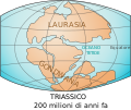
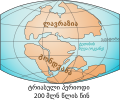
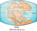
 Triassic 250.png 1,542 × 794; 177 KB
-
 TRIASSIC EARTH.jpg 624 × 520; 112 KB
-
 Valbara map.png 239 × 92; 10 KB
-

-
 Önceden rodinya.png 220 × 165; 26 KB
-
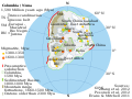
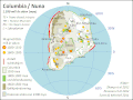
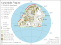
 רודיניה.png 1,259 × 1,142; 940 KB


_and_the_specimen_of_HB_site_(black),_through_time_from_Bajocian%E2%80%93Bathonian_(A),_Tithonian_(B),_Barremian%E2%88%92Aptian_(C),_and_Albian%E2%88%92Cenomanian_(D).jpg)


_and_the_specimen_of_HB_site_(black),_through_time_from_Bajocian%E2%80%93Bathonian_(A),_Tithonian_(B),_Barremian%E2%88%92Aptian_(C),_and_Albian%E2%88%92Cenomanian_(D).jpg)


.png)


.PNG)

