Category:Maps of protected areas in Isère
Media in category "Maps of protected areas in Isère"
The following 13 files are in this category, out of 13 total.
-
 Bois de La Bâtie automne 2017 02.jpg 2,136 × 1,892; 2.4 MB
-
 Chamrousse UT4M abc23.jpg 2,288 × 1,712; 765 KB
-
 Marais des Seiglières mai 2018 abc3.jpg 2,560 × 1,920; 1.54 MB
-
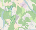
 Périmètre PNR de la Chartreuse.png 1,000 × 1,050; 1.05 MB
-
 Périmètre RNN Etang du Grand-Lemps rnn115.png 1,236 × 824; 338 KB
-
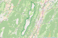
 Périmètre RNN Haute vallée du Béranger rnn14.png 1,239 × 828; 432 KB
-
 Périmètre RNN Haute vallée du Vénéon rnn13.png 1,238 × 826; 262 KB
-
 Périmètre RNN Hauts de Chartreuse rnn136.png 1,234 × 823; 829 KB
-
 Périmètre RNN Hauts plateaux du Vercors rnn74.png 1,116 × 1,424; 1.09 MB
-
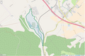
 Périmètre RNR Etang de Haute-Jarrie rnr74.png 1,296 × 818; 401 KB
-
 Périmètre RNR Etang de Saint-Bonnet rnr76.png 1,296 × 819; 966 KB
-
 Périmètre RNR Etangs de Mépieu rnr159.png 996 × 818; 395 KB
-
 Périmètre RNR Isles du Drac rnr201.png 960 × 885; 805 KB


