Category:Maps of provinces of Zimbabwe
Subcategories
This category has only the following subcategory.
Media in category "Maps of provinces of Zimbabwe"
The following 26 files are in this category, out of 26 total.
-
 Province of Bulawayo.svg 250 × 228; 30 KB
-
 Province of Harare.svg 250 × 228; 30 KB
-
 Province of Manicaland.svg 250 × 228; 30 KB
-
 Province of Mashonaland Central.svg 250 × 228; 30 KB
-
 Province of Mashonaland East.svg 250 × 228; 30 KB
-
 Province of Mashonaland West.svg 250 × 228; 30 KB
-
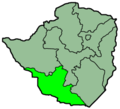
 Province of Masvingo.svg 250 × 228; 30 KB
-
 Province of Matabeleland North.svg 250 × 228; 30 KB
-
 Province of Matabeleland South.svg 250 × 228; 30 KB
-
 Province of Midlands.svg 250 × 228; 30 KB
-
 Provinces of Zimbabwe.svg 630 × 490; 33 KB
-
 Zim-provinces blank.jpg 250 × 228; 7 KB
-
 Zimbabwe Base Map.png 1,117 × 708; 353 KB
-
 Zimbabwe Province Mashonaland Central.png 250 × 228; 18 KB
-
 Zimbabwe Province Masvingo.png 250 × 228; 18 KB
-
 Zimbabwe Provinces Bulawayo 250px.png 250 × 228; 18 KB
-
 Zimbabwe Provinces Harare 250px.png 250 × 228; 18 KB
-
 Zimbabwe Provinces Manicaland 250px.png 250 × 228; 18 KB
-
 Zimbabwe Provinces Mashonaland East 250px.png 250 × 228; 18 KB
-
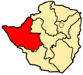
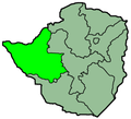
 Zimbabwe Provinces Mashonaland West 250px.png 250 × 228; 18 KB
-
 Zimbabwe Provinces Matabele North 250px.png 250 × 228; 18 KB
-
 Zimbabwe Provinces Matabele South 250px.png 250 × 228; 18 KB
-
 Zimbabwe Provinces Midlands.png 250 × 228; 18 KB
-
 Zimbabwe Provinces numbered 300px.png 300 × 275; 27 KB
-
 Zimbabwe.geohive.gif 620 × 537; 37 KB
-
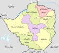 مقاطعات زيمبابوي.png 2,000 × 1,815; 322 KB


