Category:Maps of the 1949 Armistice Agreements
Media in category "Maps of the 1949 Armistice Agreements"
The following 25 files are in this category, out of 25 total.
-
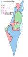
 1947-UN-Partition-Plan-1949-Armistice-Comparison-ar.png 367 × 1,029; 56 KB
-
 1947-UN-Partition-Plan-1949-Armistice-Comparison-ar.svg 500 × 1,029; 29 KB
-
 1947-UN-Partition-Plan-1949-Armistice-Comparison-es.svg 500 × 1,029; 33 KB
-
 1947-UN-Partition-Plan-1949-Armistice-Comparison-hu.svg 500 × 1,029; 33 KB
-
 1947-UN-Partition-Plan-1949-Armistice-Comparison-it.svg 500 × 1,029; 33 KB
-
 1947-UN-Partition-Plan-1949-Armistice-Comparison.png 367 × 1,029; 26 KB
-
 1947-UN-Partition-Plan-1949-Armistice-Comparison.svg 367 × 1,029; 48 KB
-
 1949 Israeli-Syrian General Armistice Agreement (png).png 4,227 × 11,591; 1.82 MB
-
 After war.jpg 387 × 599; 32 KB
-

-
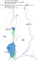
 Ein Gev - Al Samra - Al Hamma Demilitarized Zone.png 1,337 × 2,354; 160 KB
-
 GolanHistoricalBorders-es.svg 1,252 × 2,000; 255 KB
-
 GolanHistoricalBorders.svg 534 × 855; 54 KB
-
 Golanhöhen.svg 744 × 1,052; 335 KB
-
 Huleh Demilitarized Zone.png 1,106 × 3,441; 195 KB
-
 Israel Syria DMZ section A land ownership as of May 1948.pdf 3,608 × 4,150; 3.69 MB
-
 Israel Syria DMZ section B land ownership as of May 1948.pdf 2,381 × 7,020; 2.8 MB
-
 Israel Syria DMZ section C land ownership as of May 1948.pdf 4,820 × 9,520; 12.01 MB
-
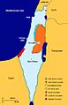
 Israel-1947-1949.jpg 500 × 880; 29 KB
-
 Khan al-Duwayr Demilitarized Zone.png 603 × 755; 28 KB
-
 Palestina-1947-1949.gif 200 × 561; 25 KB
-
 Palestine 1947 and 1950 de.svg 522 × 688; 102 KB
-
 Palestinian territories under military control of Israel Egypt and Jordan 1949.jpg 2,828 × 8,208; 6.21 MB
-
 UN armistice lines 1949 (cropped).jpg 298 × 528; 94 KB
-
 UN armistice lines 1949.jpg 324 × 624; 90 KB


.png)


.jpg)

.png)