Category:Maps of the 2010 Czech parliamentary election
Media in category "Maps of the 2010 Czech parliamentary election"
The following 24 files are in this category, out of 24 total.
-
 2010 Czech election.svg 2,876 × 1,113; 271 KB
-
 2010 Czech parliamentary election map.png 2,560 × 2,000; 516 KB
-
 Cartogram projector cz.png 1,099 × 620; 197 KB
-
 Czech parliament elections 2010 - districts, turnout.svg 512 × 384; 693 KB
-
 Czech parliament elections 2010 - regions winners map.svg 3,417 × 1,956; 257 KB
-
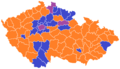
 Czech parliament elections districts winner map 2010.svg 1,021 × 587; 225 KB
-
 Czech parliamentary election 2010 - districts - turnout.png 619 × 356; 15 KB
-
 Czech parliamentary election 2010 - districts - winner.png 619 × 356; 14 KB
-
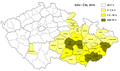
 Czech parliamentary election 2010 - regions - winner.png 1,281 × 878; 18 KB
-
 KDU-ČSL - 2010.svg 1,045 × 604; 229 KB
-
 KDU-ČSL 2010.png 615 × 355; 19 KB
-
 KSČM - 2010.svg 1,045 × 604; 229 KB
-
 KSČM 2010.png 615 × 355; 19 KB
-
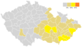
 Lidovci2010.PNG 1,053 × 624; 55 KB
-
 ODS - 2010.svg 1,045 × 604; 229 KB
-
 ODS 2010.png 615 × 355; 18 KB
-
 Poslanecká sněmovna (2010).svg 1,045 × 604; 24 KB
-
 Poslanecká sněmovna 2010.png 615 × 355; 23 KB
-
 Procenta-SZ Volby-PSPCR-2010 podle-okresu.png 1,053 × 624; 27 KB
-
 TOP 09 - 2010.svg 1,045 × 604; 229 KB
-
 TOP09 2010.png 615 × 355; 19 KB
-
 VV - 2010.svg 1,045 × 604; 229 KB
-
 ČSSD - 2010.svg 1,045 × 604; 229 KB
-
 ČSSD 2010.png 615 × 355; 18 KB


.svg)


