Category:Maps of the Aleutian Islands
Media in category "Maps of the Aleutian Islands"
The following 77 files are in this category, out of 77 total.
-

-
-
-
 1924 map of American fliers route from Alaska to Japan.png 2,928 × 1,033; 101 KB
-
 Adak be.svg 1,000 × 960; 223 KB
-
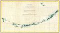
 Admiralty Chart No 2460 Kamchatka to Kodiak Island, Published 1884, New Edition 1917.jpg 10,900 × 13,831; 45.18 MB
-
 Admiralty Chart No 2460 Kamchatka to San Francisco, Published 1942, Large Corrections 1960.jpg 17,721 × 11,259; 53.78 MB
-
 Agattu Island.png 2,062 × 1,360; 875 KB
-
 Alaska and the Aleutians Map.jpg 1,059 × 732; 124 KB
-
 Alaska and the Aleutians.jpg 5,020 × 2,775; 1.44 MB
-
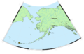
 Alaska.PNG 602 × 362; 58 KB
-
 Aleuten Lage-blank.png 707 × 545; 703 KB
-
 Aleuten Lage-he.png 884 × 681; 867 KB
-
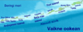
 Aleuten Lage.png 707 × 545; 631 KB
-
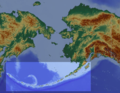
 Aleutian arc physical geography.png 1,457 × 1,277; 1.95 MB
-
 Aleutian Islands map - 2.png 640 × 456; 101 KB
-
 Aleutian Islands map nationalatlas.jpg 1,676 × 660; 782 KB
-
 Aleutian Islands Reservation EO 1733 illustration.jpg 3,210 × 2,252; 475 KB
-
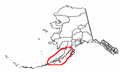
 Aleutian Islands, outlined in red.png 610 × 383; 298 KB
-
 Aleutian Islands.PNG 747 × 470; 310 KB
-
 AleutianIslands.jpeg 650 × 182; 30 KB
-
 Aleutians.jpg 407 × 595; 197 KB
-
 Aleuty.png 514 × 315; 15 KB
-
 Aleuudide-idaosa.png 1,708 × 666; 515 KB
-
 Amak Island EO 5318 illustration.png 2,916 × 3,689; 97 KB
-
 Amaknak Island EO 5243 illustration.png 2,849 × 3,823; 461 KB
-
 Amchitka Island Map.jpg 794 × 564; 113 KB
-
 AmchitkaTestSites he.svg 693 × 469; 28 KB
-
 AmchitkaTestSites-es.svg 693 × 469; 28 KB
-
 AmchitkaTestSites.svg 693 × 469; 28 KB
-
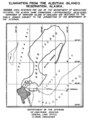
 Andreanof Map Delarof.jpg 560 × 249; 60 KB
-
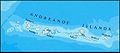 Andreanof Map.jpg 560 × 249; 24 KB
-

-
 AttuIslandWW2.png 520 × 308; 57 KB
-
 Avo map 46.png 767 × 500; 168 KB
-
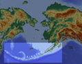
 Bering Sea Aleutian Is Alaska map.png 1,457 × 1,277; 2.04 MB
-
 Beringmeer-Aleuten-Karte.png 1,457 × 1,281; 2.04 MB
-
 Blueak.png 250 × 155; 7 KB
-
 BobrofMap.png 1,141 × 1,281; 152 KB
-
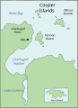 Cooper Islands.svg 274 × 376; 390 KB
-
 EB9 Aleutian Islands.jpg 1,619 × 560; 270 KB
-
 EQuakes-aleutian-beachballl-2014.pdf 1,845 × 1,454; 1.19 MB
-

-
 Fox Islands.jpg 538 × 213; 20 KB
-
 Foxi-saarte-kaart.png 1,861 × 657; 508 KB
-

-

-
 Karte Aleuten-Vulkanbogen.png 1,457 × 1,281; 1.95 MB
-
 Kasatochi Island map.jpg 1,263 × 875; 298 KB
-
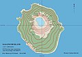
 Kiska Island.png 8,640 × 8,640; 21.46 MB
-
 KiskaMap.jpg 1,000 × 900; 248 KB
-
 KoniujiMap.png 791 × 693; 53 KB
-
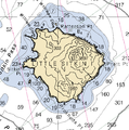 Littlesitkin.png 561 × 568; 55 KB
-
 M 7.9 - 19km SE of Little Sitkin Island, Alaska - intensity.jpg 612 × 719; 52 KB
-
 Map amutka.gif 500 × 414; 104 KB
-
 Map of alaska volcanoes bogoslof.jpg 640 × 456; 226 KB
-
 Map of alaska volcanoes carlisle.jpg 640 × 456; 226 KB
-
 Map of alaska volcanoes gilbert.jpg 640 × 456; 225 KB
-

-
 Mapa Hipsometryczna-Aleuty i Rów Aleucki.png 2,610 × 1,441; 508 KB
-
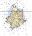
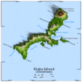
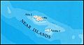 Near Islands.jpg 363 × 197; 39 KB
-
 NizkiMap.png 1,600 × 1,118; 720 KB
-
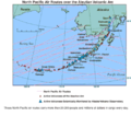 North-Pacific-air-routes.png 500 × 441; 34 KB
-
 Operational Navigation Chart E-11, 4th edition.jpg 9,254 × 6,772; 8.08 MB
-
 Operational Navigation Chart E-12, 3rd edition.jpg 9,254 × 6,728; 7.61 MB
-
 Operational Navigation Chart E-13, 2nd edition.jpg 9,254 × 6,792; 6.99 MB
-
 PacificTheaterAug1942.jpg 1,199 × 873; 256 KB
-
 Rat Islands II.jpg 435 × 197; 14 KB
-

-
 Rigobert-Bonne-Atlas-de-toutes-les-parties-connues-du-globe-terrestre MG 0007.tif 5,196 × 3,522; 52.39 MB
-
 SemisopochnoiMap.png 1,286 × 1,021; 554 KB
-
 SemisopochnoiNauticalChart.png 1,112 × 987; 156 KB
-
 TanagaMap.png 781 × 600; 356 KB
-
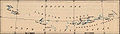
 The American Museum journal (c1900-(1918)) (17537803104).jpg 2,864 × 1,132; 535 KB
-
 Txu-pclmaps-topo-us-attu-1970.jpg 5,951 × 4,572; 2.92 MB
-
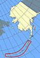
 Western Aleutians.png 826 × 478; 10 KB
-
 Карта Восточного океана, 1851.jpg 3,328 × 2,000; 441 KB


_(20156926900).jpg)


_entitled_%22An_act_to_protect_the_seal_fisheries_of_Alaska,_and_for_other_purposes_(1910)_(14597636957).jpg)
.jpg)


_(14577807837).jpg)


%27_(11063826264).jpg)
%27_(16590198315).jpg)
)_(17537803104).jpg)