Category:Maps of the Battle of the Somme
Media in category "Maps of the Battle of the Somme"
The following 94 files are in this category, out of 94 total.
-
 2nd Division Battle of the Ancre, November 1916.png 1,115 × 681; 1.08 MB
-
 2nd Division operations at Delville Wood, 27 July 1916.png 572 × 560; 511 KB
-
 2nd Division operations, Guillemont, 8 August 1916.png 588 × 520; 660 KB
-
 2nd Division positions Battle of the Ancre 14 November 1916.png 601 × 535; 276 KB
-
 2nd Division positions Courcelette sector 1916-1917.png 811 × 554; 548 KB
-
 2nd Division, Delville Wood, 27 July 1916.jpg 739 × 718; 127 KB
-
 47th Division attack on Eaucourt l'Abbaye, Somme October, 1916.png 857 × 1,129; 295 KB
-
 51st (Highland) Div positions March 1918.png 506 × 320; 295 KB
-
 51st Division, Beaumont Hamel, 13 November 1916.jpg 850 × 628; 117 KB
-
 55th (West Lancashire) Division positions at Guillemont.jpg 740 × 730; 154 KB
-

-
 5th Brigade, 2nd Division, Ancre, 13 November 1916.jpg 593 × 713; 97 KB
-
 Ancre front, 1916.png 448 × 556; 131 KB
-
 Anglo-French attack at Combles, Somme, 25 September 1916.jpg 373 × 437; 21 KB
-
 Attacks of the Sixth Army, October 1916.png 420 × 683; 144 KB
-
 Banks of the Somme, 1916.jpg 880 × 441; 66 KB
-
 Battle of Beaumont Hamel, Somme, 13 November 1916.jpg 652 × 305; 29 KB
-
 Battle of the Somme 1916 map blank.png 600 × 990; 81 KB
-
 Battle of the Somme 1916 map HE.png 600 × 990; 209 KB
-
 Battle of the Somme 1916 map.png 600 × 990; 63 KB
-
 British attacks, Somme, October 1916.jpg 711 × 339; 38 KB
-
 Capture of Thiepval plateau, Somme, 26 September 1916.jpg 652 × 322; 31 KB
-
 Capture of Thiepval, Battle of Thiepval Ridge, September 1916.png 592 × 384; 193 KB
-
 Chalk areas, northern France.jpg 646 × 629; 228 KB
-
 Delville Wood 14 July 1916 (cropped).png 3,440 × 2,517; 1.79 MB
-
 Delville Wood 14 July 1916.png 3,523 × 2,722; 1.86 MB
-
 Delville Wood 16 July 1916.png 3,523 × 2,722; 2.01 MB
-
 Delville Wood 17 July 1916 V2.4.png 3,523 × 2,722; 1.99 MB
-
 Delville Wood 18 20 July 1916.png 3,523 × 2,722; 1.99 MB
-
 Delville Wood Terrein.png 3,523 × 2,722; 1.6 MB
-
 Delville Wood 15 July 1916.png 3,523 × 2,722; 1.91 MB
-
 Delville Wood, 27 July 1916.jpg 610 × 605; 97 KB
-
 Diagram 56th Division Battle of Le Transloy, October 1916.png 1,075 × 1,728; 844 KB
-
 First day of the Somme (27721597050).jpg 2,400 × 1,600; 4.08 MB
-
 First day of the Somme (annotated) (27923768911).jpg 3,244 × 2,480; 1.49 MB
-
 British attack, Somme, 15 September 1916.jpg 536 × 368; 28 KB
-

-
 Franco-British advances on the Somme, July-August 1916.png 635 × 695; 297 KB
-
 French advances on the Somme, 1-11 july 1916.jpg 634 × 795; 76 KB
-
 French operational area, Somme 1916.png 885 × 1,111; 389 KB
-
 French operations, south bank of the Somme, 1916.jpg 624 × 889; 66 KB
-
 Geological cross-section Somme area.jpg 931 × 382; 136 KB
-

-

-
 Gloster territorials somme.svg 1,102 × 652; 3.89 MB
-
 Glosters at Guillemont.png 525 × 387; 141 KB
-
 Glosters on the somme - july 1916.png 741 × 711; 421 KB
-
 Glosters on the Somme - July 1916.svg 741 × 711; 1.05 MB
-
 Ground captured on the north bank of the Somme, 1916.png 408 × 496; 168 KB
-
 Guards Division, Somme, evening 15 September 1916.jpg 1,129 × 967; 297 KB
-
 Guards Division, Somme, night, 25 September 1916.jpg 1,080 × 946; 341 KB
-
 Guillemont, 8 August 1916.jpg 628 × 551; 156 KB
-
 High Wood, September-October 1916.jpg 923 × 1,269; 312 KB
-
 Lihons, Chaulnes, south of the Somme, 1916.jpg 335 × 145; 10 KB
-

-
 Map of the 35th div on the Somme and Ancre 1918.svg 1,374 × 666; 366 KB
-
 Map of the Battle of Somme .jpg 1,199 × 787; 196 KB
-
 Map of the Battle of the Somme, 1916-es.svg 2,611 × 1,996; 1.48 MB
-
 Map of the Battle of the Somme, 1916.svg 1,204 × 921; 529 KB
-
 Map of the east of the Somme front 1916.png 872 × 1,396; 1.19 MB
-
 Map of the Fricourt-Contalmaison area,1916.jpg 394 × 466; 83 KB
-
 Map of the Somme Front (GSGS 3316) Fall of 1916.jpg 2,193 × 3,001; 1.14 MB
-
 Map of the Somme Front (GSGS 3317) Fall of 1916.jpg 2,193 × 3,000; 1.05 MB
-
 Map of the Somme front in 1916.png 556 × 749; 483 KB
-
 Map showing villages south of the Somme west of Peronne, 1916.jpg 500 × 526; 55 KB
-
 Map Somme front 1916.png 888 × 1,420; 1.34 MB
-
 Mont St. Quentin, Peronne (Times 20).jpg 433 × 622; 139 KB
-
 Overview Glosters on the Somme.png 797 × 580; 364 KB
-

-
 Pozieres map J00158 (png).png 395 × 551; 196 KB
-
 Pozieres map J00158.jpg 425 × 654; 172 KB
-
 Recouly-1919-Foch le vainqueur-4-avance de la Somme 1916.jpg 1,914 × 1,371; 1.18 MB
-
 Serre-lès-Puisieux (Serre) 1916.png 206 × 268; 53 KB
-
 MontStQuentinMap1916.jpg 593 × 454; 66 KB
-
 Bazentin le Petit 14 July 1916 map.png 1,000 × 632; 113 KB
-
 British plan Somme 1 July 1916.png 600 × 952; 64 KB
-
 La Boisselle sector 1 July 1916.png 900 × 1,350; 285 KB
-
 Sausage Valley Somme 1 July 1916 map.jpg 900 × 642; 162 KB
-
 Somme area from Longueval to Combles, 1916.png 874 × 886; 773 KB
-
 Somme attack fronts, 1916.jpg 529 × 800; 148 KB
-
 Somme Front, 1916.jpg 566 × 764; 241 KB
-
 Somme Front, July to October 1916.jpg 585 × 782; 234 KB
-
 Somme relief map.jpg 900 × 1,446; 890 KB
-
 Somme-Schlacht 1916.jpg 880 × 1,376; 369 KB
-
 Ancre sector 1 July 1916.png 990 × 1,240; 298 KB
-
 Attack on Schwaben Redoubt 1 July 1916 map.jpg 596 × 500; 71 KB
-
 Hawthorn Ridge (1 July 1916).png 520 × 431; 180 KB
-
 Topography, Flanders and Artois.jpg 908 × 1,036; 351 KB
-
 Warinairbeingsto02rale 0242 png.png 1,271 × 1,314; 4.09 MB
-
 Western Front Somme focus.jpg 677 × 372; 50 KB
-
 Worldwari map13 largerview.jpg 1,242 × 961; 217 KB
-
 Württ. Verbände Somme-schlacht 1916.jpg 845 × 1,349; 246 KB
-
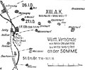 XIII. A.K. Somme 1916..jpg 652 × 538; 108 KB
-
 XIV Reserve Corps advance from Bapaume, 27-28 September 1914.png 635 × 558; 201 KB


_Div_positions_March_1918.png)

_Division_positions_at_Guillemont.jpg)
,_19_July_1916.png)


.png)


.jpg)
_(27923768911).jpg)


_Fall_of_1916.jpg)
_Fall_of_1916.jpg)


.jpg)


.png)


_1916.png)


.png)


