Category:Maps of the Charles River
Media in category "Maps of the Charles River"
The following 27 files are in this category, out of 27 total.
-
-

-

-

-
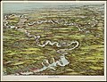
 1899 Bird's Eye View of Boston.jpg 5,400 × 3,600; 4.76 MB
-
-

-
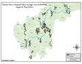
 Alewife Reservation and Alewife Brook master plan (2003) (17950191821).jpg 2,634 × 3,864; 3.88 MB
-
 Boston 1814.jpg 1,580 × 1,444; 573 KB
-

-
 Charles River (2674608088).jpg 2,000 × 1,526; 3.85 MB
-
 Charles River (2674612841).jpg 1,797 × 2,000; 2.66 MB
-
 Charlesrivermap.png 1,000 × 1,000; 587 KB
-
 CharlestownBattleMap1775.jpg 631 × 750; 87 KB
-
 Henry Bond map of Watertown Massachusetts.gif 4,460 × 2,863; 438 KB
-
 Lechmere Canal, Cambridge (2673751701).jpg 2,000 × 1,310; 1.94 MB
-
 Lexington Concord Siege of Boston crop.jpg 2,861 × 2,188; 1.89 MB
-
 Narratives of the Indian wars, 1675-1699 (1913) (14598000359).jpg 3,143 × 2,630; 999 KB
-
 Oldandnewboston.jpg 291 × 410; 32 KB
-
 Plan of Charlestown (3855695619).jpg 2,000 × 1,341; 2.18 MB
-

-
 Segment Map Index 2009.pdf 1,650 × 1,275; 465 KB
-
 Segment Map Index.jpg 1,056 × 816; 253 KB
-
 Siege of Boston 1776.jpg 1,800 × 1,277; 476 KB
-
 The Columbian magazine - or, monthly miscellany (3178) (14597575178).jpg 2,982 × 2,002; 1.02 MB
-
 View of East Cambridge, Mass., 1879 (2674960185).jpg 2,000 × 1,604; 2.71 MB
-
 Warren Bridge - Boston-Charlestown - 1.jpg 4,478 × 3,493; 6.73 MB


.jpg)

_(17950191821).jpg)

.jpg)
.jpg)
.jpg)


.jpg)

_(14598000359).jpg)

.jpg)
.jpg)


_(14597575178).jpg)
.jpg)
