Category:Maps of the City of Coventry
Media in category "Maps of the City of Coventry"
The following 29 files are in this category, out of 29 total.
-
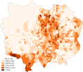
 African Coventry 2011 census.png 20,237 × 17,548; 11.81 MB
-
 Arab Coventry 2011 census.png 20,170 × 17,490; 11.77 MB
-
 Asian Coventry 2011 census.png 20,104 × 17,432; 11.75 MB
-
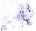
 Bangladeshi Coventry 2011 census.png 20,237 × 17,549; 11.76 MB
-
 Black Coventry 2011 census.png 20,104 × 17,432; 11.24 MB
-
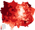 British Coventry 2011 census.png 20,171 × 17,490; 11.14 MB
-
 Buddhism Coventry 2011 census.png 20,103 × 17,433; 11.94 MB
-
 Caribbean Coventry 2011 census.png 20,170 × 17,490; 12 MB
-
 Chinese Coventry 2011 census.png 20,170 × 17,490; 11.82 MB
-
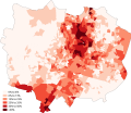
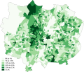
 Christianity Coventry 2011 census.png 20,237 × 17,548; 11.66 MB
-
 Coventry (42993274032).png 1,930 × 1,304; 126 KB
-
 COVENTRY (49911038512).png 2,160 × 1,080; 252 KB
-
 Coventry in England (special marker).svg 816 × 991; 1.32 MB
-
 Coventry in England (zoom).svg 816 × 991; 1.3 MB
-
 Coventry in England.svg 816 × 991; 1.32 MB
-
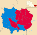
 Coventry UK local election 2004 map.svg 1,340 × 1,266; 260 KB
-
 Coventry UK local election 2007 map.svg 1,340 × 1,266; 259 KB
-
 Coventry UK local election 2018 map.svg 1,340 × 1,266; 260 KB
-
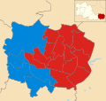
 Coventry UK local election 2021 map.svg 1,340 × 1,266; 260 KB
-
 Coventry UK locator map.svg 1,425 × 974; 720 KB
-
 Coventry UK ward map 2008 (results).svg 512 × 484; 381 KB
-
 Coventry UK ward map 2010 (blank).svg 1,340 × 1,266; 259 KB
-
 Coventry UK ward map 2010 (results).svg 1,340 × 1,266; 258 KB
-
 Coventry UK ward map 2011 (results).svg 1,340 × 1,266; 258 KB
-
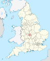
 EnglandCoventry.png 200 × 247; 18 KB
-
 Hinduism Coventry 2011 census.png 20,170 × 17,491; 11.95 MB
-
 Indian Coventry 2011 census.png 20,237 × 17,548; 11.97 MB
-
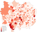
 Irish Coventry 2011 census.png 20,171 × 17,490; 12.01 MB
-
 WMids-Coventry.png 200 × 134; 9 KB


.png)
.png)
.svg)
.svg)


.svg)
.svg)
.svg)


.svg)