Category:Maps of the City of London
Subcategories
This category has the following 3 subcategories, out of 3 total.
Media in category "Maps of the City of London"
The following 23 files are in this category, out of 23 total.
-
 City of London in Greater London.svg 1,425 × 1,140; 1.4 MB
-
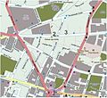
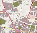
 Barbican area map with stations and hotels.png 1,281 × 798; 1.01 MB
-
 Boroughs of London City of London.svg 900 × 695; 42 KB
-
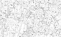
 Bull and Mouth Inn, Ordnance Survey map 1875.jpg 1,154 × 922; 850 KB
-
 Cheapside & Poultry 1875 Ordnance Survey map.jpg 9,450 × 5,860; 13.7 MB
-
 Cheapside & Poultry 1916 2nd revision Ordnance Survey map.jpg 9,480 × 5,850; 21.68 MB
-
 Cheapside & Poultry 1958 Ordnance Survey map.jpg 9,460 × 5,820; 7.75 MB
-
 City of London map 01.jpg 4,778 × 3,708; 815 KB
-
 City of London map 01.svg 4,778 × 3,708; 16 KB
-
 City of London UK location map.svg 1,425 × 1,140; 763 KB
-
 Clerkenwell Road, London.jpg 1,519 × 487; 586 KB
-
 ELondon.PNG 254 × 368; 11 KB
-

-
 Fore Street, London.jpg 1,142 × 554; 318 KB
-
 G20 meltdown march routes.png 748 × 953; 548 KB
-
 Holborn-viaduct-map.svg 671 × 615; 269 KB
-
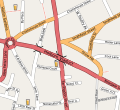
 Ian Tomlinson route, 1 April 2009 (3).JPG 708 × 650; 253 KB
-
 Ian Tomlinson route, 1 April 2009.JPG 708 × 650; 111 KB
-
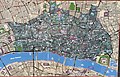 London Map (27867914970).jpg 3,263 × 2,082; 2.29 MB
-
 LondonCity.svg 962 × 744; 19 KB
-
 Map of London near Armourer's Hall.JPG 3,000 × 4,000; 4.29 MB
-
 Monkwell Square, London.jpg 897 × 432; 199 KB
-
 Turnmill Street, London.jpg 680 × 616; 338 KB


.jpg)


.JPG)

.jpg)


