Category:Maps of the City of Oxford
Media in category "Maps of the City of Oxford"
The following 28 files are in this category, out of 28 total.
-
 Barton and Sandhills ward map, Oxford 2010.svg 990 × 1,266; 257 KB
-
 Blackbird Leys ward map, Oxford 2010.svg 990 × 1,266; 257 KB
-
 Carfax ward map, Oxford 2010.svg 990 × 1,266; 257 KB
-
 Churchill ward map, Oxford 2010.svg 990 × 1,266; 257 KB
-
 Cowley Marsh ward map, Oxford 2010.svg 990 × 1,266; 257 KB
-
 Cowley ward map, Oxford 2010.svg 990 × 1,266; 257 KB
-
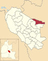
 Headington Hill and Northway ward map, Oxford 2010.svg 990 × 1,266; 257 KB
-
 Headington ward map, Oxford 2010.svg 990 × 1,266; 257 KB
-
 Hinksey Park ward map, Oxford 2010.svg 990 × 1,266; 257 KB
-
 Holywell ward map, Oxford 2010.svg 990 × 1,266; 257 KB
-
 Iffley Fields ward map, Oxford 2010.svg 990 × 1,266; 257 KB
-
 Jericho and Osney ward map, Oxford 2010.svg 990 × 1,266; 257 KB
-
 Littlemore ward map, Oxford 2010.svg 990 × 1,266; 257 KB
-
 Lye Valley ward map, Oxford 2010.svg 990 × 1,266; 257 KB
-
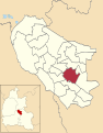
 Marston ward map, Oxford 2010.svg 990 × 1,266; 257 KB
-
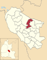
 North ward map, Oxford 2010.svg 990 × 1,266; 257 KB
-
 Northfield Brook ward map, Oxford 2010.svg 990 × 1,266; 257 KB
-
 Oxford City Council election 2016.png 3,498 × 889; 247 KB
-
 Oxford UK locator map.svg 1,077 × 1,266; 921 KB
-
 Oxford UK ward map 2010 (blank).svg 990 × 1,266; 256 KB
-
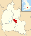
 OxfordshireOxford.png 200 × 267; 17 KB
-
 Quarry and Risinghurst ward map, Oxford 2010.svg 990 × 1,266; 257 KB
-
 Rose Hill and Iffley ward map, Oxford 2010.svg 990 × 1,266; 257 KB
-
 St Clement's ward map, Oxford 2010.svg 990 × 1,266; 257 KB
-
 St Margaret's ward map, Oxford 2010.svg 990 × 1,266; 257 KB
-
 St Mary's ward map, Oxford 2010.svg 990 × 1,266; 257 KB
-
 Summertown ward map, Oxford 2010.svg 990 × 1,266; 257 KB
-
 Wolvercote ward map, Oxford 2010.svg 990 × 1,266; 257 KB


.svg)