Category:Maps of the Commonwealth of Nations
Subcategories
This category has the following 3 subcategories, out of 3 total.
M
S
Media in category "Maps of the Commonwealth of Nations"
The following 19 files are in this category, out of 19 total.
-
 CANZUK and dependencies.svg 2,560 × 1,314; 1.26 MB
-
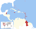 CARIFTA and the rest of the Commonwealth Caribbean 1971-1972.png 2,000 × 1,600; 219 KB
-
 Carte des pays du Commonwealth.png 1,920 × 975; 270 KB
-
 Commonwealth and BOTs.jpg 782 × 363; 175 KB
-
 Commonwealth Caribbean.svg 512 × 410; 1.61 MB
-
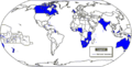 Commonwealth map.png 660 × 335; 29 KB
-
 Commonwealth members by joining date.png 3,132 × 1,589; 539 KB
-
 Commonwealth of Nations (simple).png 1,425 × 625; 54 KB
-
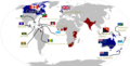
 Commonwealth of Nations interested states.png 1,357 × 628; 33 KB
-
 Commonwealth of Nations members with territories.png 1,357 × 628; 55 KB
-
 Commonwealth of Nations prospective members (simple).png 1,425 × 625; 33 KB
-
 Commonwealth of Nations prospective members.png 1,357 × 628; 49 KB
-
 Commonwealth of Nations.png 1,480 × 625; 44 KB
-
 Commonwealth realms map for talk 2023.png 1,920 × 975; 342 KB
-
 Commonwealth realms map with names and flags.png 1,920 × 975; 452 KB
-
 Commonwealth-potential.png 2,000 × 1,015; 259 KB
-
 Postempire Orgs Map.png 1,357 × 628; 38 KB
-
 Postempire Orgs Map.svg 2,754 × 1,398; 1.05 MB
-
 The Commonwealth of Nations.PNG 2,753 × 1,400; 156 KB


.png)


.png)


