Category:Maps of the Durrani Empire
Media in category "Maps of the Durrani Empire"
The following 13 files are in this category, out of 13 total.
-
 Afgempdur.jpg 364 × 359; 109 KB
-
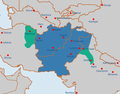
 Afghanistan unter Ahmad Schah Durrani.PNG 364 × 359; 60 KB
-
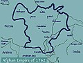
 Alleged extent of Durrani Empire 1762.jpg 345 × 284; 28 KB
-
 Durrani Empire (greatest extent).svg 553 × 553; 271 KB
-
 Durrani Empire 1747 1862 AD 2.png 620 × 429; 23 KB
-
 Durrani Empire 1747 1862 AD.png 832 × 650; 105 KB
-
 Durrani Empire 1762.jpg 461 × 350; 38 KB
-
 DurraniEmpireatitsgreatestextent.jpg 364 × 359; 108 KB
-
 Extent of Durrani Empire.png 364 × 359; 100 KB
-
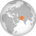
 Flag map of the Durrani Empire.png 772 × 572; 57 KB
-
 Map of the Durrani Empire.png 3,196 × 1,840; 13.19 MB
-
 Mapofiran1756.png 3,415 × 2,987; 738 KB
-
 Mapofkhorasan1775.png 1,952 × 2,144; 258 KB


.svg)


