Category:Maps of the Dutch Caribbean
Other areas: Anguilla · Aruba · Bermuda · British Virgin Islands · Cayman Islands · Curaçao · Dutch Caribbean · Falkland Islands · French Guiana · Greenland · Guadeloupe · Martinique · Montserrat · Puerto Rico · Saint Barthélemy · Saint-Martin · Saint Pierre and Miquelon · Sint Maarten · South Georgia and the South Sandwich Islands · Turks and Caicos Islands · United States Virgin Islands
This category is for maps of the Dutch Caribbean grouping all islands in the Caribbean (all in the Lesser Antilles) that are dependencies of the Kingdom of the Netherlands.
They are consisting of 3 separate states in the Kingdom (Aruba, Curaçao, Sint Maarten), and the 3 groups of islands of the Caribbean Netherlands (Bonaire, Sint Eustatius, and Saba) that are now special municipalities of the state of the Netherlands within the Kingdom.
The Dutch Caribbean is only a geographic region and not a formal subdivision of the Kingdom. Among them, 3 groups of islands located in the Leeward Antilles (along the coasts of South America) are also named informally the ABC Islands (Aruba, Bonaire et Curaçao), the other islands are located in the Leeward Islands (the northern-eastern part of the Lesser Antilles).

Subcategories
This category has the following 7 subcategories, out of 7 total.
!
L
Media in category "Maps of the Dutch Caribbean"
The following 12 files are in this category, out of 12 total.
-
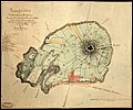 Carte Topographique de l'Ile Saint Eustache Samuel Fahlberg 1830.jpg 5,458 × 4,540; 18.71 MB
-
 Generale verzamelkaart der Nederlandsche Westindische bezittingen, KITLV 47D34.tiff 5,458 × 4,162; 65.02 MB
-

-

-

-

-
 On the birds of the islands of Aruba, Curaçao, and Bonaire (1893) (14563454738).jpg 3,302 × 2,398; 871 KB
-
 Overzicht grenzen bovenwinds 201806 1.jpg 2,242 × 2,618; 955 KB
-
 Plaan van Sint Eustatius Alexander de Lavaux 1741.jpg 1,103 × 857; 204 KB
-
 St Martin, Saba, St Eustatius (map).jpeg 1,051 × 1,378; 161 KB
-

-
 Zonegrens benedenw nl.jpg 760 × 839; 65 KB

,_NG-1064-10_(cropped).jpg)
,_NG-1064-10_(cropped2).jpg)
,_NG-1064-10_(cropped3).jpg)
,_NG-1064-10.jpg)
_(14563454738).jpg)


.jpeg)
.jpg)
