Category:Maps of the Dutch East India Company - China
Media in category "Maps of the Dutch East India Company - China"
The following 30 files are in this category, out of 30 total.
-
 AMH-7966-KB Map of China and Korea.jpg 2,400 × 2,241; 1.29 MB
-
 AMH-5164-NA Map of Quinam, Toncquin, Cochin-China and Aynam.jpg 2,400 × 1,698; 472 KB
-
 AMH-5166-NA Map of China and Formosa.jpg 2,400 × 1,696; 495 KB
-
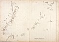 AMH-5167-NA Map of the east coast of China and several Japanese islands.jpg 2,400 × 1,692; 422 KB
-
 AMH-5169-NA Map of the river of Canton.jpg 2,400 × 1,716; 496 KB
-
 AMH-5170-NA Map of Macao and the mouth of the river of Canton.jpg 2,400 × 1,689; 363 KB
-
 AMH-5508-NA Map of the coast of China, from Conglay to Lantao.jpg 2,400 × 1,403; 543 KB
-
 AMH-5645-KB Map of China.jpg 2,400 × 1,875; 625 KB
-
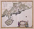
 AMH-5646-KB Map of Fokien, China.jpg 2,400 × 2,005; 738 KB
-
 AMH-5648-KB Map of Guandong, China.jpg 2,400 × 1,990; 650 KB
-
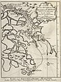
 AMH-5649-KB Map depicting the journey by Joan Nieuhoff from Canton to Peking.jpg 2,400 × 2,024; 682 KB
-
 AMH-6176-NA Chart of the Hoksieu River, China.jpg 2,400 × 1,988; 555 KB
-
 AMH-6177-NA Map of the Chinese sea and coast.jpg 2,400 × 1,960; 646 KB
-
 AMH-6662-KB Map of China.jpg 1,940 × 2,400; 1.06 MB
-
 AMH-6701-NA Map of a part of the Chinese Sea and coast and Formosa.jpg 2,087 × 2,400; 597 KB
-
 AMH-6721-KB Map of China and Korea.jpg 2,400 × 2,187; 1,001 KB
-
 AMH-6745-NA Map of the Chinese coast near Tonquin.jpg 2,400 × 1,669; 745 KB
-
 AMH-6815-KB Map of part of the Chinese coast.jpg 1,929 × 2,400; 1.14 MB
-
 AMH-7930-KB Map of Japan, China and Korea.jpg 2,400 × 1,815; 837 KB
-
 AMH-7931-KB Map of the coast of Tonquin and Cochinchina.jpg 1,727 × 2,400; 579 KB
-
 AMH-7965-KB Map of the mouth of the Canton River (cropped).jpg 1,752 × 2,336; 858 KB
-
 AMH-7965-KB Map of the mouth of the Canton River.jpg 1,846 × 2,400; 891 KB
-
 AMH-7973-KB Map of China and Korea.jpg 2,400 × 1,842; 1.1 MB
-
 AMH-7974-KB Map of the bay of Hocsieu.jpg 2,400 × 1,905; 796 KB
-
 AMH-8083-KB Map of the bay of Hocksieu.jpg 2,400 × 1,763; 700 KB
-
 AMH-8129-KB Map of part of Japan, China and Formosa.jpg 2,400 × 2,077; 680 KB
-
 AMH-8181-KB Three charts of the Chinese coast near Kanton (cropped).jpg 1,536 × 2,048; 653 KB
-
 AMH-8181-KB Three charts of the Chinese coast near Kanton.jpg 1,715 × 2,400; 759 KB
-
 AMH-8182-KB Map of China.jpg 2,400 × 2,104; 1.37 MB
-
 Titsingh route 1794-1795.jpg 984 × 1,539; 416 KB


.jpg)


.jpg)


