Category:Maps of the Dutch East India Company - Taiwan
Media in category "Maps of the Dutch East India Company - Taiwan"
The following 33 files are in this category, out of 33 total.
-
 AMH-4839-NA Map of the Taouan peninsula.jpg 2,400 × 1,118; 381 KB
-
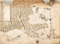
 AMH-5187-NA Map of the Pescadores and the west coast of Formosa.jpg 2,400 × 1,875; 558 KB
-
 AMH-6178-NA Map of Taiwan.jpg 2,400 × 971; 304 KB
-
 1625 Map of Formosa-Taiwan by the Dutch 荷蘭人所繪福爾摩沙-臺灣.jpg 600 × 374; 97 KB
-
 AMH-6613-NA Map of Formosa.jpg 2,400 × 1,551; 499 KB
-
 AMH-6415-NA Map of Zeelandia on Formosa.jpg 2,400 × 1,642; 654 KB
-
 AMH-7131-NA Map of Spanish fort at Tamsui, later in hands of the VOC.jpg 9,167 × 6,437; 9.08 MB
-
 NL-HaNA 4.VELH 141-groot.jpg 9,167 × 6,437; 31.88 MB
-
 1640 Map of Formosa-Taiwan by Dutch (魍港局部).png 1,080 × 1,012; 1.95 MB
-
 AMH-4601-NA Estates at Saccam.jpg 2,400 × 1,724; 848 KB
-
 AMH-5413-NA Chart showing the Wancan region on Formosa.jpg 2,400 × 1,850; 619 KB
-
 AMH-6416-NA Map of Zeelandia and environs, Formosa.jpg 11,511 × 10,343; 13.85 MB
-
 Map of Roads and Cultivated Fields in the Saccam Area, 1644.jpg 1,000 × 717; 284 KB
-
 400px-04141-2.jpg 400 × 310; 27 KB
-
 AMH-4602-NA Map of Tamsuy and Kelang.jpg 2,400 × 1,863; 1.1 MB
-
 Dutch Tamsui Map 1654.png 1,305 × 869; 1.69 MB
-
 Kaartje van Tamsuy en omleggende dorpen, zoo mede het eilandje Kelang.png 1,540 × 1,122; 6.6 MB
-
 Map of Danshui and Surrounding Areas, Including the Island of Jilong, 1654.jpg 1,000 × 782; 447 KB
-
 Old map of Taipei.jpg 500 × 387; 38 KB
-
 《Kaartje van Tamsuy en omleggende dorpen, zoo mede het eilandje Kelang》.jpg 3,206 × 2,290; 1.91 MB
-
 17th century Keelung map.jpg 882 × 560; 81 KB
-
 AMH-2520-NA Map of Fort Zeelandia.jpg 2,400 × 1,677; 477 KB
-
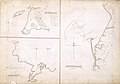
 Navigation Charts of Jilong and the Bay of Tayouan..jpg 1,000 × 695; 232 KB
-
 AMH-7930-KB Map of Japan, China and Korea.jpg 2,400 × 1,815; 837 KB
-
 AMH-4600-NA Map of the fort at Kelang.jpg 1,904 × 2,400; 634 KB
-
 AMH-5166-NA Map of China and Formosa.jpg 2,400 × 1,696; 495 KB
-
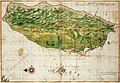
 AMH-7971-KB Map of Formosa.jpg 2,400 × 1,862; 694 KB
-
 AMH-8129-KB Map of part of Japan, China and Formosa.jpg 2,400 × 2,077; 680 KB
-
 AMH-8182-KB Map of China.jpg 2,400 × 2,104; 1.37 MB
-
 1640 Map of Formosa-Taiwan by Dutch 荷蘭人所繪福爾摩沙-臺灣.jpg 8,168 × 5,640; 9.77 MB
-
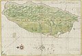
 AMH-6670-NA Map of the island of Formosa.jpg 2,400 × 1,662; 691 KB
-
 Het Eyland Formosa & Pisca Dores.jpg 1,000 × 696; 439 KB
-
 The Island Formosa and the Pescadores.jpg 1,280 × 885; 575 KB


.png)


