Category:Maps of the European Free Trade Association
Subcategories
This category has only the following subcategory.
Media in category "Maps of the European Free Trade Association"
The following 12 files are in this category, out of 12 total.
-
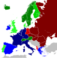 Cold War Europe Economic Alliances.svg 450 × 456; 495 KB
-
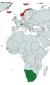 EFTA and SACU areas on the World Map.tif 1,597 × 2,701; 16.46 MB
-
 EFTA Canada FTA.svg 863 × 443; 1.54 MB
-
 EFTA free trade agreements.PNG 1,425 × 625; 51 KB
-
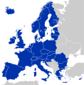
 EU DCFTA EFTA.svg 680 × 520; 606 KB
-
 EU EFTA DCFTA EUCU.svg 680 × 520; 597 KB
-
 EU-EFTA-CIS.svg 1,320 × 430; 496 KB
-
 EU28 Single-Euro-Payment-Area -2013-.svg 450 × 456; 317 KB
-
 Free trade areas in Europe.svg 1,320 × 430; 482 KB
-
 FTAs with EFTA.svg 1,104 × 566; 1.41 MB
-
 Millitary alliances of Europe.svg 870 × 760; 2.54 MB
-
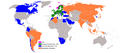
 Western world according to WorldAtlas.png 7,000 × 3,526; 2.69 MB


