Category:Maps of the European exploration of Africa
Media in category "Maps of the European exploration of Africa"
The following 51 files are in this category, out of 51 total.
-
 Bruceroutes2.PNG 473 × 556; 137 KB
-
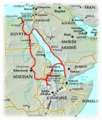
 Mungo Parks Route 1795-97 and 1805-06.png 1,947 × 1,134; 622 KB
-
 Parkroutes.JPG 522 × 382; 43 KB
-
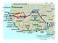
 Carte trajet Mollien.jpg 600 × 681; 62 KB
-
 Clapperton-map.jpg 554 × 375; 33 KB
-
 I viaggi di Vinco.JPG 778 × 1,306; 137 KB
-
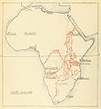
 Routes of European explorers in Africa, to 1853.jpg 1,466 × 2,041; 1.11 MB
-
 Heinrich Barth's route through Africa, 1850 to 1855 (Deutsch).jpeg 2,550 × 2,898; 1.26 MB
-

-
 Heinrich Barth's route through Africa, 1850 to 1855.jpg 3,192 × 3,172; 921 KB
-
 Journeys of Silva Porto - map.jpg 2,554 × 1,876; 893 KB
-
 BurtonExploration-fr.png 804 × 486; 40 KB
-
 BurtonExploration.png 804 × 486; 36 KB
-
 Map livingstone travels africa.jpg 2,717 × 2,271; 592 KB
-
 Bagamoyo-Tanganjika.JPG 2,368 × 1,817; 1.03 MB
-
 Carte du voyage the Stanley - How I found Livingstone (fr).png 2,532 × 1,500; 1.15 MB
-
 Les expeditions de la Societe Internationale Africaine.png 835 × 646; 670 KB
-
 Les explorations du Sud et du Centre africains jusquen 1876.jpg 628 × 677; 45 KB
-

-
 Les Explorateurs du Haut Congo LOEuvre de Stanley et de Hanssens.png 3,949 × 2,891; 6.8 MB
-
 Les Explorations du Kassai.png 877 × 625; 717 KB
-
 Emin pasha relief expedition map 1890.png 1,002 × 722; 1.41 MB
-
 Soudan français-Binger.jpg 3,834 × 5,298; 3.67 MB
-
 Itinéraire-Binger.jpg 691 × 518; 117 KB
-
 Stairs Expedition Map lo-res.jpg 699 × 681; 105 KB
-
 Stairs Expedition Map.PNG 491 × 480; 443 KB
-
 Map of William Astor Chanler's East Africa Journey 1892-1894.jpg 536 × 710; 70 KB
-
 Mission Foureau-Lamy.jpg 897 × 670; 234 KB
-
 Mohun telegraph expedition.JPG 734 × 766; 199 KB
-
 Croisiere noire.svg 1,390 × 1,295; 723 KB
-
 34 of 'Afrika. Eine allgemeine Landeskunde, etc' (11211302705).jpg 2,784 × 1,817; 1.38 MB
-
 35 of 'Afrika. Eine allgemeine Landeskunde, etc' (11210370385).jpg 2,784 × 1,817; 1.13 MB
-

-
 Aethiopisches Hochland.png 11,383 × 9,091; 145 MB
-
 Carte de l'Afrique politique en 1888 par E Banninfg pour le BCK - IMG 4379.jpg 3,888 × 5,184; 5.37 MB
-
 Carte du Cordofan et du pays des Noubas.png 8,834 × 10,216; 136.77 MB
-

-
 Entwurf zu dem Kriegsschauplatze in Asyr vor dem Jahr 1824.png 15,396 × 12,887; 302.28 MB
-
 Karte der Nordküste Afrika's.png 11,158 × 8,991; 158.07 MB
-
 Karte von Afrika mit Angabe der wichtigsten Entdeckungswege.png 8,072 × 8,040; 89.63 MB
-
 Karte von Inner-Afrika, Blatt 10 - Unyamwesi.png 9,033 × 7,428; 94.16 MB
-
 Karte von Inner-Afrika, Blatt 8 - Gondokoro.png 8,870 × 7,565; 87.12 MB
-
 Lieut. V.L. Cameron's Aufnahme des südlichen Theiles des Tancanjika See's, 1874.png 1,702 × 4,367; 6.53 MB
-
 Loeuvrecivilisat00reni 0253.jpg 988 × 723; 101 KB
-
 Loeuvrecivilisat00reni 0341.jpg 988 × 720; 83 KB
-
 Loeuvrecivilisat00reni 0345 Angola.jpg 988 × 720; 88 KB
-
 Mission Foureau-Lamy Agadès Tiloua.jpg 789 × 592; 731 KB
-
 Mission Foureau-Lamy Damergou.jpg 930 × 620; 488 KB
-
 Mission Foureau-Lamy Tableau.jpg 1,402 × 2,881; 4.6 MB
-
 Tigre. Aethiopisches Hochland (cropped).png 3,908 × 2,421; 18.31 MB
-
 Wyld's New Map of Africa shewing Stanley's route... - btv1b53060259x.jpg 6,882 × 8,658; 8.52 MB


.jpeg)


.png)


.jpg)
.jpg)
.jpg)


.jpg)


.png)
