Category:Maps of the General Government
Media in category "Maps of the General Government"
The following 25 files are in this category, out of 25 total.
-
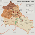 General Government camps of Lublin Reservation.png 2,299 × 2,280; 636 KB
-
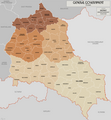
 General Government for the occupied Polish territories (1941).png 2,299 × 2,280; 543 KB
-
 General Government for the occupied Polish territories.png 1,610 × 1,735; 521 KB
-
 28 Nazi Germany 1940.jpg 2,301 × 1,956; 2.73 MB
-
 AGAD Mapa generalnego gubernatorstwa z 39.png 3,610 × 4,774; 27.5 MB
-
 Dystrykt krakowski 1.png 2,026 × 2,596; 2.1 MB
-
 Dystrykt warszawski.jpg 3,000 × 2,052; 1.17 MB
-
 General Government (1942).svg 450 × 456; 500 KB
-
 General.governement.map.1943.jpg 690 × 709; 771 KB
-
 Generalgouvernement fur die besetzten polnischen gebiete.png 1,610 × 1,735; 523 KB
-
-
 Generalgouvernement.png 2,092 × 2,505; 2.71 MB
-
 GeneralgouvernementKarte1940.png 1,295 × 1,385; 404 KB
-
 GeneralGovernement.1940.jpg 583 × 656; 442 KB
-
 GeneralGovernment1940Map.png 2,594 × 2,770; 899 KB
-
 Generalne gubernatorstwo 1942.png 2,086 × 2,480; 1.53 MB
-
 Generalne gubernatorstwo 1945-es.svg 629 × 705; 772 KB
-
 Generalne gubernatorstwo 1945.png 2,092 × 2,505; 1.95 MB
-
 Generalne Gubernatorstwo.jpg 730 × 711; 79 KB
-
 Gengub admin.png 2,122 × 2,428; 1.66 MB
-
 Germany1941.png 698 × 600; 240 KB
-
 NaziGaue.png 1,224 × 1,052; 431 KB
-
 Reichsgau Wartheland (Karte).png 2,092 × 2,505; 2.81 MB
-
 Territoriale Veränderungen nach dem Polenfeldzug 1939.png 2,092 × 2,505; 2.42 MB
-
 מפת הגנרלגוברנמן.png 1,055 × 1,138; 305 KB

.png)


.svg)


.png)

