Category:Maps of the Gulf of İskenderun
Media in category "Maps of the Gulf of İskenderun"
The following 14 files are in this category, out of 14 total.
-
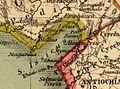
 Antioch Alexandria and Seleucia.png 589 × 349; 540 KB
-

-
 1942 German military map - Syrien- Sheet Antakya (cropped).jpg 10,672 × 11,572; 24.76 MB
-
 1942 German military map - Syrien- Sheet Antakya.jpg 16,326 × 19,954; 51.57 MB
-
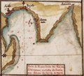
 Admiralty Chart No 2632 Anamur Burnu to Iskenderun Korfezi, Published 1955.jpg 18,359 × 11,244; 32.3 MB
-

-
 Admiralty Chart No 2632 Syria sheet 1 Gulf of Iskanderun to Markhab, Published 1861.jpg 8,299 × 12,294; 13.21 MB
-
 Battle issus movements.png 738 × 563; 31 KB
-
 Coast of Syria. Iyskanderin Latakiah and Markhab.jpg 8,037 × 6,006; 11.83 MB
-

-
 Gulf of Iskenderun - Taboas geraes de toda a navegação LOC 78653638-21 (cropped).tif 1,960 × 1,773; 9.94 MB
-
 Heinrich Kiepert. Asia citerior.S.Issieus.jpg 715 × 532; 100 KB
-

-


.jpg)


.jpg)


_(cropped).jpg)


_Leve_et_Dresse_en_1854_._._._Par_Ordre_de_L%27Empereur_Sous_le_Ministeree_de_Son_Excellence_Mr._L%27Amiral_Hamelin_._._._1856.jpg)