Category:Maps of the Kīlauea 2016 eruptions
Media in category "Maps of the Kīlauea 2016 eruptions"
The following 6 files are in this category, out of 6 total.
-
 USGS Kīlauea image-312 20160212.jpg 3,300 × 2,550; 2.18 MB
-
 USGS Kīlauea image-318 20160325.jpg 2,200 × 1,700; 1.99 MB
-
 USGS Kīlauea image-322 20160524.jpg 3,148 × 2,382; 5.17 MB
-
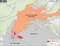 USGS Kīlauea image-325 20160602.jpg 3,300 × 2,550; 3.01 MB
-
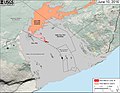 USGS Kīlauea image-327 20160610.jpg 2,200 × 1,700; 1.65 MB
-
 USGS Kīlauea image-346 20160726.jpg 3,300 × 2,550; 3.22 MB


