Category:Maps of the Majapahit Empire
Media in category "Maps of the Majapahit Empire"
The following 18 files are in this category, out of 18 total.
-
 Administratif Majapahit Kingdom id.png 1,316 × 864; 461 KB
-
 Majapahit Core and Provinces-pt.svg 512 × 228; 372 KB
-
 Majapahit Core and Provinces-sr.svg 512 × 228; 341 KB
-
 Majapahit Core and Provinces.svg 512 × 228; 341 KB
-
 Majapahit Empire de.svg 512 × 297; 520 KB
-
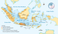
 Majapahit Empire id.svg 512 × 297; 546 KB
-
 Majapahit Empire-es.svg 1,380 × 800; 2.12 MB
-
 Majapahit Empire-pt.svg 512 × 297; 613 KB
-
 Majapahit Empire-sr.svg 512 × 297; 525 KB
-
 Majapahit Empire-zh-hans.svg 512 × 297; 520 KB
-
 Majapahit Empire.svg 512 × 297; 524 KB
-
 Majapahit Expansion.gif 635 × 369; 361 KB
-
 Majapahit Kingdom.jpg 3,264 × 2,787; 1.3 MB
-
 Map of Majapahit Empire.png 1,600 × 750; 56 KB
-
 Map of the Subordinate Kingdom of Majapahit.png 3,264 × 2,155; 2.9 MB
-
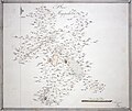
 Plan of Majapahit (BM 1939,0311,0.5.36 1).jpg 2,500 × 2,103; 478 KB
-
 Plan of Majapahit (BM 1939,0311,0.5.36).jpg 1,934 × 1,624; 417 KB
-
 Suhita.png 360 × 160; 36 KB


.jpg)
.jpg)
