Category:Maps of the Merovingian territory in the 7th-century
| Preceded by: Maps of 6th-century Gauls/Merovingian territory |
Maps of the Merovingian territory in the 7th-century 601 AD-700 AD |
Succeeded by: Maps of the Merovingian territory in the 8th-century |
Media in category "Maps of the Merovingian territory in the 7th-century"
The following 5 files are in this category, out of 5 total.
-

-
 651 CE, Europe.svg 512 × 438; 1.56 MB
-
 Francia el 628.svg 755 × 784; 259 KB
-
 Frankish dominions 629.svg 846 × 838; 249 KB
-
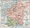 Frankish kingdoms in 628.jpg 1,239 × 1,149; 355 KB
.jpg)


