Category:Maps of the Muisca Confederation
Media in category "Maps of the Muisca Confederation"
The following 13 files are in this category, out of 13 total.
-
 Altiplano Cundiboyacense (subdivisions).png 1,740 × 1,600; 6.57 MB
-
 Altiplano Cundiboyacense.png 1,740 × 1,600; 6.59 MB
-
 Colombia MuiscaLocationMap.jpg 4,556 × 4,556; 7.22 MB
-
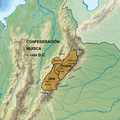
 ConfederaciónMuisca.png 2,500 × 2,500; 8.87 MB
-
 Conmuisca.webp 389 × 389; 220 KB
-
 Conquest of Colombia.png 1,192 × 1,480; 2.31 MB
-
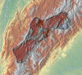
 Map of Sierra Nevada de Santa Marta.png 1,456 × 1,376; 3.77 MB
-
 Mapa del Territorio Muisca.svg 774 × 785; 269 KB
-
 Mapa Imperio Muisca.PNG 1,000 × 1,320; 89 KB
-
 Pueblos Muiscas del rincón de Saboyá.png 3,840 × 2,560; 3.66 MB
-
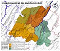 Pueblos Muiscas del Rincón de Vélez.jpg 2,522 × 2,160; 1.03 MB
-
 Sabana de Bogota.png 1,068 × 902; 2.4 MB
-
 Territorio dos muiscas.jpg 1,024 × 1,159; 187 KB
.png)


