Category:Maps of the Niagara River
Media in category "Maps of the Niagara River"
The following 57 files are in this category, out of 57 total.
-

-
 18 of 'Free Niagara' (11185423515).jpg 2,202 × 2,949; 1.57 MB
-
 1829 Black Rock Harbour map.jpg 3,662 × 2,227; 1.42 MB
-
 1843 Blackwell Map of Niagara Falls, New York - Geographicus - NiagaraFalls-haines-1843.jpg 4,000 × 2,348; 3.12 MB
-

-
 US-NY(1891) p610 BUFFALO AND THE NIAGARA RIVER.jpg 1,741 × 933; 1.02 MB
-
 1904 NYCRR Buffalo.jpg 1,817 × 3,595; 1.05 MB
-
 241 of 'The History of Canada' (11192597644).jpg 1,590 × 2,619; 789 KB
-

-
-

-
-
 838 of 'Die Erde. Eine allgemeine Erd- und Länderkunde, etc' (11236945105).jpg 1,683 × 1,532; 803 KB
-

-
 Buffalo, Double Page Plate No. 20 (Map bounded by Porter Ave., Niagara River, Ferry St.) NYPL2055436.tiff 7,102 × 5,327, 2 pages; 108.5 MB
-
 Buffalo, Double Page Plate No. 21 (Map bounded by Niagara River, Bradley St., Tryon Pl., Ferry St.) NYPL2055437.tiff 7,062 × 5,297, 2 pages; 107.29 MB
-

-
 Buffalo, Double Page Plate No. 24 (Map bounded by Grove St., Cass St., N. Elmwood Ave., Amherst St., Niagara River) NYPL2055440.tiff 7,096 × 5,322, 2 pages; 108.31 MB
-
 Buffalo, V. 1, Double Page Plate No.16 (Map bounded by Amherst St., Rees St., Bird Ave., Niagara River) NYPL2056899.tiff 7,094 × 5,321, 2 pages; 108.26 MB
-
 Buffalo, V. 1, Double Page Plate No.27 (Map bounded by Niagara River, Bird Ave., Grant St., Hampshire St.) NYPL2056910.tiff 7,057 × 5,292, 2 pages; 107.11 MB
-

-
 Buffalo, V. 1, Double Page Plate No.6 (Map bounded by Arthur St., Bush St., Amherst St., Niagara River) NYPL2056889.tiff 7,057 × 5,292, 2 pages; 107.11 MB
-
 Buffalo, V. 3, Double Page Plate No. 24 (Map bounded by Ferry Rd., E. Branch Niagara River, W. Branch Niagara River) NYPL2056970.tiff 7,196 × 5,397, 2 pages; 111.38 MB
-
 Buffalo, V. 3, Double Page Plate No. 8 (Map bounded by Niagara River, State Ditch, 10th Ave., Two mile Creek Rd.) NYPL2056954.tiff 7,145 × 5,359, 2 pages; 109.81 MB
-
 Buffalo, V. 3, Double Page Plate No.1 (Map of outline Greater Buffalo New York) NYPL2056947.tiff 7,163 × 5,372, 2 pages; 110.36 MB
-
 Bulletin of the Buffalo Society of Natural Sciences (1901) (20259157550).jpg 3,536 × 7,410; 10.74 MB
-
 Darlington map of the Niagra region 1680.png 782 × 497; 956 KB
-
-
 Diversion of water from the Great lakes and Niagara river (1921) (14784061535).jpg 4,782 × 3,074; 2.27 MB
-
 Fenian Raid of 1866.jpg 636 × 850; 110 KB
-

-

-

-
 Grand Island (Township); South Buffalo (Village); Buffalo Plains (Village) NYPL1584513.tiff 7,230 × 4,780; 98.88 MB
-
 Grand-River-Niagara-Part1.tif 4,685 × 3,986; 17.83 MB
-
 Grand-River-Niagara-Part2.tif 4,685 × 3,986; 17.83 MB
-
 Image taken from page 19 of 'Free Niagara' (15968072494).jpg 688 × 1,070; 173 KB
-
 Map of part of Niagara River NYPL435011.tiff 4,624 × 4,777; 63.2 MB
-
 Map of the Niagara Falls region, including the Niagara River and the Niagara Peninsula. LOC 74694649.jpg 17,240 × 12,359; 20.61 MB
-
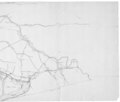
 Map of the Niagara Frontier, 1869.jpg 482 × 787; 325 KB
-
 Mouth of the Niagara River, 1798.jpg 5,909 × 4,716; 3.34 MB
-
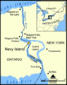 Navy Island map.png 478 × 600; 174 KB
-
 Niagara and Onondoga escarpments, 1825.jpg 567 × 360; 115 KB
-
 Niagara Falls Suspension Bridges.svg 1,295 × 985; 271 KB
-
 Niagara Gorge RGS map 1906 gscmcm 0926 e 1905 mn01.pdf 2,914 × 5,658; 2.94 MB
-
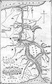
 Niagara map.jpg 2,205 × 1,319; 522 KB
-
 Niagara peninsula, 1827.png 1,069 × 768; 1,002 KB
-
 Niagara River 1812.jpg 1,527 × 858; 155 KB
-
 Niagra River and Territory, 1812.jpg 1,473 × 2,305; 550 KB
-
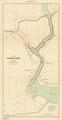
 Sketch of the Niagara River. NYPL435013.tiff 4,672 × 4,724; 63.15 MB
-
 Squaw & Bird Islands map.png 604 × 806; 21 KB
-

-
 The harbours and ports of Lake Ontario (1857) (14771547464).jpg 2,596 × 3,204; 892 KB
-

-
 Tuscarora Reservation.jpg 2,988 × 5,312; 4.83 MB
-
 Whirlpool River Map (22126795576).jpg 403 × 580; 76 KB
-
 Wpdms usgs photo lake tonawanda.jpg 400 × 300; 48 KB
%27_(11125830686).jpg)
.jpg)


.jpg)
_p610_BUFFALO_AND_THE_NIAGARA_RIVER.jpg)

.jpg)
%27_(11112592903).jpg)
.jpg)
.jpg)
.jpg)
.jpg)

_(20259157550).jpg)

_(14781663724).jpg)
_(14784061535).jpg)


_(14597981549)_(cropped).jpg)

.jpg)


_(14741116536).jpg)
_(14771547464).jpg)
_(14597542678).jpg)

.jpg)
