Category:Maps of the Northwest Territories
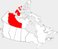
Provinces and territories of Canada: Alberta · British Columbia · Manitoba · New Brunswick · Newfoundland and Labrador · Nova Scotia · Ontario · Prince Edward Island · Quebec · Saskatchewan · Northwest Territories · Nunavut · Yukon
Wikimedia category | |||||
| Upload media | |||||
| Instance of | |||||
|---|---|---|---|---|---|
| |||||
Subcategories
This category has the following 11 subcategories, out of 11 total.
!
M
- Maps of Victoria Island, Canada (13 F)
- Maps of Yellowknife (7 F)
Media in category "Maps of the Northwest Territories"
The following 81 files are in this category, out of 81 total.
-
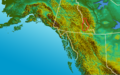 Alaska Panhandle-relief Logan Mountains.png 1,176 × 731; 1.49 MB
-
 Alaska Panhandle-relief Mackenzie Mountains.png 1,176 × 731; 1.47 MB
-
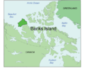
 Banks (Canada).PNG 747 × 492; 15 KB
-
 Banks Island.png 668 × 536; 133 KB
-
 Banks Island.svg 599 × 524; 143 KB
-
 Banks.png 280 × 230; 12 KB
-
 BanksIslandCloseup.png 503 × 467; 12 KB
-
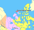
 Canada Prince Patrick Island.png 320 × 329; 10 KB
-
 Canada Provinces Territories 1949.png 280 × 230; 20 KB
-
 Canada territories map.png 262 × 212; 4 KB
-
 Canada territories map.svg 403 × 306; 32 KB
-
 Canada-1882.png 694 × 600; 198 KB
-
 Canada-1895.png 1,000 × 864; 73 KB
-
 Dehcho Region.jpg 302 × 431; 29 KB
-
 District-Ungava-1898.png 280 × 230; 14 KB
-
 EglintonIslandCloseup.png 534 × 591; 10 KB
-
 Ellef Ringnes Island-sr.svg 668 × 536; 534 KB
-
 Emeraldisland.png 320 × 329; 12 KB
-
 FormerNWTcapitals.png 411 × 359; 65 KB
-
 Fort Good Hope in Canada.png 582 × 532; 1.18 MB
-
 Franklin Last Expedition Map.jpg 597 × 510; 98 KB
-
 Franklin Route german.jpg 1,168 × 546; 182 KB
-
 Franklin's lost expedition map ru.png 602 × 522; 42 KB
-
 Franklin's lost expedition map.png 602 × 520; 121 KB
-
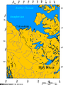 Hay River connection to the Arctic Ocean.png 514 × 691; 32 KB
-
 Inuvik region nt.jpg 302 × 431; 29 KB
-
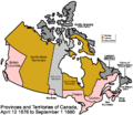 Keewatin1876.png 1,000 × 864; 54 KB
-
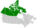
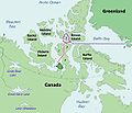
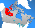
 Location map Northwest Territories 2.png 500 × 709; 99 KB
-
 Location map Northwest Territories.png 500 × 709; 70 KB
-
 Mackenzie King Island.png 668 × 536; 136 KB
-
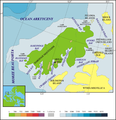
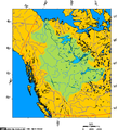 Mackenzie River drainage basin.PNG 513 × 569; 57 KB
-
 Mackenzie-King-Borden-Brock-Inseln.jpg 900 × 931; 76 KB
-
 Map indicating Amundsen Gulf, Northwest Territories, Canada.png 395 × 370; 60 KB
-
 Map indicating Banks Island, New Territories, Canada.png 428 × 370; 17 KB
-
 Map indicating Banks Island, Northwest Territories, Canada.png 428 × 370; 63 KB
-
 Map indicating McClure Strait, Northwest Territories, Canada.png 420 × 380; 59 KB
-
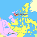 Map indicating Melville Island, northern Canada.png 375 × 375; 54 KB
-

-
-
 Map indicating Sachs Harbour, Northwest Territories, Canada.png 370 × 340; 54 KB
-
 Map indicating Victoria Island, northern Canada.png 428 × 380; 67 KB
-
 Melville island.jpg 939 × 814; 80 KB
-
 MelvilleIslandCloseupMap.png 500 × 373; 13 KB
-
 N 60, W 135.1 - W 70.8, W 120 slope map.png 8,320 × 13,874; 35.98 MB
-
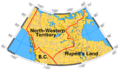 North-western-territory.png 401 × 238; 62 KB
-
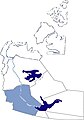
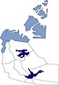
 Northwest Territories Baffin Region.png 489 × 400; 74 KB
-
 Northwest Territories Fort Smith Region.png 489 × 400; 76 KB
-
 Northwest Territories Inuvik Region.png 489 × 400; 75 KB
-
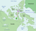
 Northwest Territories Keewatin Region.png 489 × 400; 76 KB
-
 Northwest Territories Kitikmeot Region.png 489 × 400; 76 KB
-
 Northwest Territories Köppen.svg 765 × 1,152; 1.51 MB
-
 Northwest Territories municipalities.png 1,800 × 2,550; 225 KB
-
 Northwest Territories Regions pre 1999.png 671 × 549; 112 KB
-
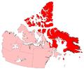
 Northwest Territories, Canada-lctr.svg 2,433 × 3,496; 104 KB
-
 LGBT Flag Map of the Northwest Territories.png 1,733 × 2,707; 39 KB
-
 Northwest Territory - USA (PSF).png 3,528 × 2,356; 2.76 MB
-
 NWT Indigenous identity 2021.svg 922 × 1,278; 1.41 MB
-
 NWT-Canada-territory.png 852 × 698; 171 KB
-
 Parry.png 534 × 730; 28 KB
-
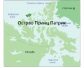 Prince Patrick Island-sr.svg 668 × 536; 534 KB
-
 Prince Patrick Island.svg 668 × 536; 534 KB
-
 Prince patryk island.png 944 × 975; 281 KB
-
 PrincePatrickIslandCloseup.png 490 × 527; 13 KB
-
 Provmap-nt.png 250 × 210; 8 KB
-
 Region 1, Northwest Territories.svg 2,000 × 2,637; 1.99 MB
-
 Region 2, Northwest Territories.svg 2,000 × 2,637; 2.03 MB
-
 Region 3, Northwest Territories.svg 2,000 × 2,637; 2.06 MB
-
 Region 4, Northwest Territories.svg 2,000 × 2,637; 2.04 MB
-
 Region 5, Northwest Territories.svg 2,000 × 2,637; 2.04 MB
-
 Region 6, Northwest Territories.svg 2,000 × 2,637; 2.04 MB
-
 SSI Micro Nunavut.jpg 534 × 680; 46 KB
-
 Ssi micro nwt coverage map.jpg 481 × 726; 52 KB
-
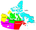
 Territories region.png 281 × 230; 22 KB
-
 The American Museum journal (1912) (18156717002).jpg 2,754 × 1,408; 629 KB
-
 Tuktoyatuk Nunavut.png 514 × 619; 27 KB
-
 Victoria Island de.svg 668 × 536; 368 KB
-
 Victoria Island.png 668 × 536; 127 KB
-
 Victoria Island.svg 573 × 499; 138 KB
-
 Victoriaisland.png 320 × 329; 11 KB
-
 VictoriaIslandMap Parker's Notch.png 504 × 540; 27 KB
-
 VictoriaIslandMap.png 504 × 540; 27 KB


.PNG)


.png)


_(18156717002).jpg)


