Category:Maps of the Ohio and Erie Canal
Media in category "Maps of the Ohio and Erie Canal"
The following 11 files are in this category, out of 11 total.
-
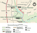 Canalvc.png 500 × 459; 73 KB
-
 Columbus Feeder Canal map.jpg 1,242 × 1,330; 334 KB
-
 Cuyahoga Valley National Park map of a portion of the canal route.jpg 5,312 × 2,988; 3.7 MB
-

-

-

-
 Ohio and Erie Canal map.jpg 1,242 × 1,330; 323 KB
-
 Ohio and Erie Canal system map captioned.jpg 1,242 × 1,330; 343 KB
-
 Ohio and Erie Canal system map.jpg 1,242 × 1,330; 321 KB
-
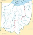
 Ohio Canals Map uk.png 942 × 1,009; 123 KB
-
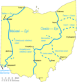
 Ohio Canals Map.svg 942 × 1,009; 109 KB


