Category:Maps of the Palatine Hill
Media in category "Maps of the Palatine Hill"
The following 32 files are in this category, out of 32 total.
-
 PalatijnKaart.jpg 226 × 227; 9 KB
-
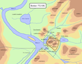
 Roma Romolo 753aC.png 1,246 × 1,386; 83 KB
-
 Rome VIII.png 1,056 × 681; 40 KB
-
 Planrome.png 1,128 × 900; 84 KB
-
 Roma nel 31 aC.png 2,520 × 2,802; 1.12 MB
-
 Giovanni Battista Nolli-Nuova Pianta di Roma (1748) 08-12.JPG 1,084 × 969; 746 KB
-
 Forum Boarium 1886.jpg 361 × 274; 37 KB
-
 Map of downtown Rome during the Roman Empire large.png 1,099 × 777; 74 KB
-

-
 Palatinen, Nordisk familjebok.jpg 635 × 503; 190 KB
-

-

-
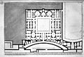
 Aula Regia (Roma Palatino).png 1,250 × 1,500; 163 KB
-
 Domus Flavia - Peristilium.png 3,006 × 1,849; 376 KB
-
 Domus Flavia - Triclinium.png 2,408 × 1,182; 662 KB
-
 Domus Flavia - Vestibulum.png 2,439 × 1,914; 253 KB
-
 Domus Flavia.png 3,006 × 4,740; 1.3 MB
-
 Domus-augustana-map.png 1,330 × 1,186; 156 KB
-
 EB1911 Rome - Plan of the Palatine.jpg 1,729 × 1,687; 1.38 MB
-
 Guide to Italy and Sicily (1911) (14579345070).jpg 3,192 × 2,852; 1.88 MB
-
 Mons Palatinus – Scalae Caci.jpg 1,730 × 1,656; 1.05 MB
-
 Mont Palatin - Plan.jpg 4,288 × 3,216; 1.34 MB
-
 Palatin-legende.jpg 1,593 × 693; 266 KB
-
 Piranesi-1077.jpg 6,400 × 4,369; 5.15 MB
-
 Piranesi-1078.jpg 6,400 × 4,331; 6.53 MB
-

-

-
 Rome and Pompeii; archaeological rambles (1896) (14598004200).jpg 1,422 × 2,018; 905 KB
-
 Rome in 753 BC.png 1,083 × 852; 86 KB
-
 Rome in 753BC.svg 1,354 × 1,065; 594 KB
-
 Rome-Romulus-753 av. J.-C..fr.svg 2,006 × 2,232; 193 KB
-
 Geschichte Roms und der Papste im Mittelalter 1898 (143026514).jpg 3,128 × 4,372; 11.2 MB


_08-12.JPG)


_(14776098514).jpg)
_(14777515634).jpg)
.png)


_(14579345070).jpg)


_(14581424730).jpg)
_(14767810422).jpg)
_(14598004200).jpg)


.jpg)